

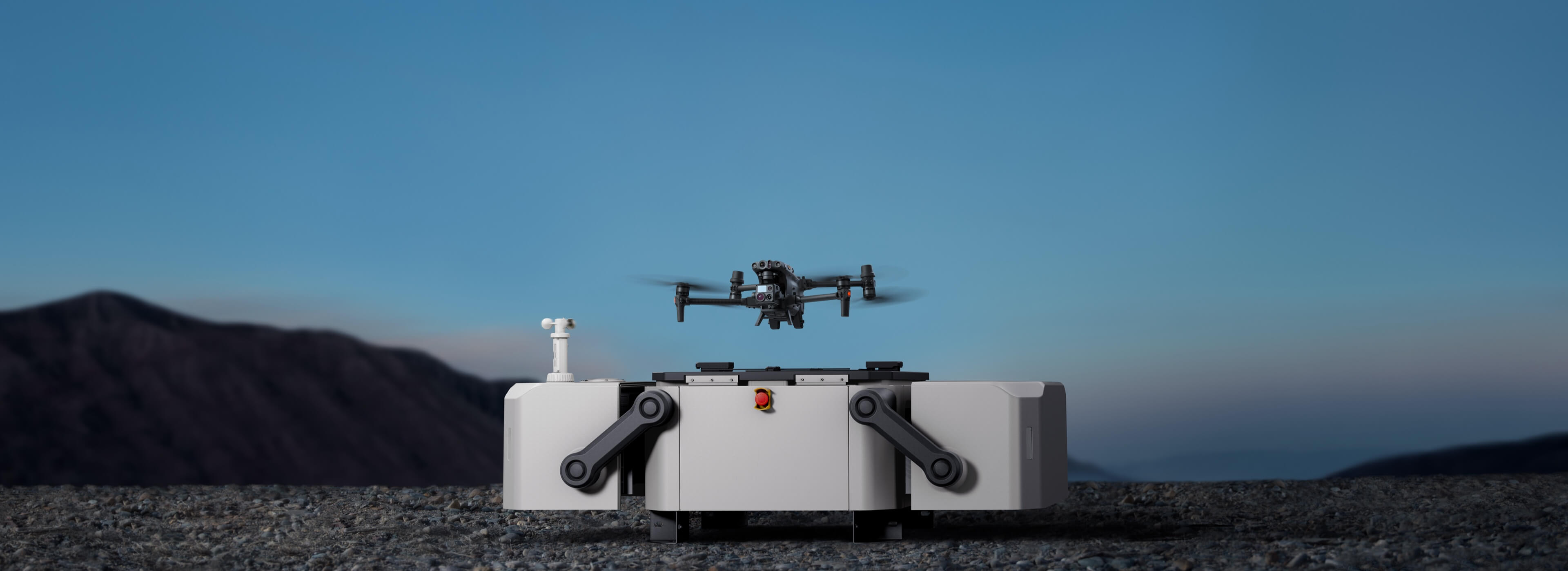
Industry Drones
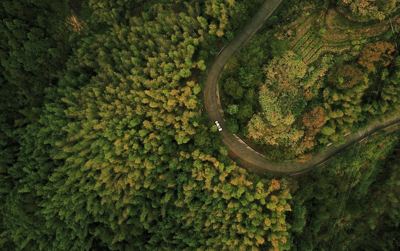
Drones are revolutionising the way traditional tasks are done. Flying sensor platforms are the next step in the digital future. Added value through sustainability, increased production or efficiency and reduced risk for staff in many areas. Motivation through innovation.

Das iPhone der Drohnenvermessung, nur günstiger. Auch im Bundle mit GNSS-Rover.
zum Artikel45Mpx metrische Vollformatkamera mit hochpräziser Georeferenzierung - Cutting Edge Technologie!
zum ArtikelDer kostengünstigste vollintegrierte LiDAR für Nutzer mit wenig Erfahrung und geringen Ansprüchen.
zum ArtikelDas iPhone der Drohnenvermessung, nur günstiger. Auch im Bundle mit GNSS-Rover.
zum Artikel45Mpx metrische Vollformatkamera mit hochpräziser Georeferenzierung - Cutting Edge Technologie!
zum ArtikelDer kostengünstigste vollintegrierte LiDAR für Nutzer mit wenig Erfahrung und geringen Ansprüchen.
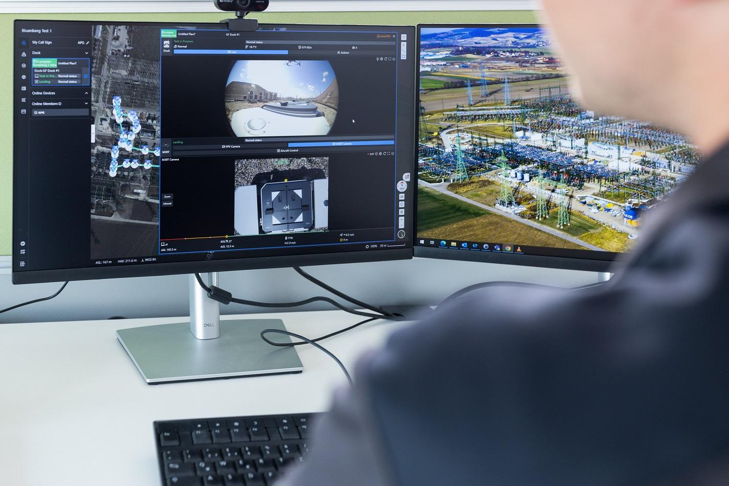
zum ArtikelFrom drones to sensors, to software, accessories and training including guidance for industrial use. We offer everything you need to effectively integrate UAVs into the workflow of your projects.
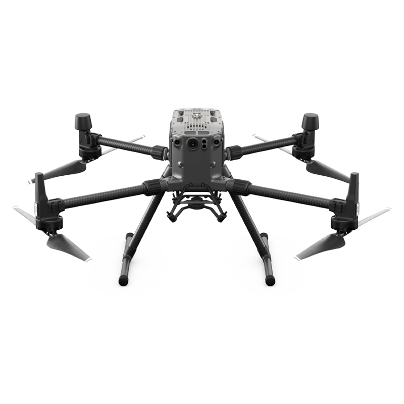
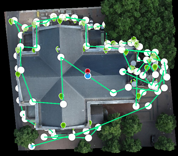
 Bild 3")
 grey background.png)
Unsere Empfehlungen
Die Worry-Free-Plus Bundles beinhalten alles, was Sie für den Start benötigen, inkl. 2 Jahre Vollkaskoversicherung durch den Hersteller mit ca. 12% Selbstbeteiligung im Schadensfalls.
Hier sehen Sie alles Drohnenmodelle zum Einstiegspreis:


 image 1_EPOTRONIC")
 image 2_EPOTRONIC")
Leistungsstarke Industriedrohne mit intelligenten Sensoren zu attraktiven Preisen.
- 30 -40 Minuten effektive Flugzeit (max. 55 Minuten ohne Nutzlast)
- 6,3kg TOM + 2,7kg Nutzlast = 9kg MTOM
- 15m/s Windresistenz, IP45
- -20° C bis 50° C Betriebstemperatur
- Vielzahl an Sensoren
- Geschütztes Investitionskapital durch den Marktführer.
- Unschlagbare "Teilkasko- und Vollkaskopakete" für DJI Drohnen und Sensoren
DJI Mavic 3 Enterprise
- Kompakt und handlich
- 4/3-Zoll-CMOS-Weitwinkelkamera mit mechanischem Verschluss
- 45 Minuten maximale Flugzeit
- Mavic 3E+RTK: Einstiegsdrohne für Vermessungsaufgaben, die zusätzlich über eine Timesync- und RTK-Funktion verfügt.
- Omnidirektionale Hinderniserkennung und -umfliegung
- Vermessungsfläche pro Flug: 2 km²
DJI Mavic 3 Thermal
- Neue Thermaldrohne der Einstiegsklasse mit 640×512 px Wärmebildkamera


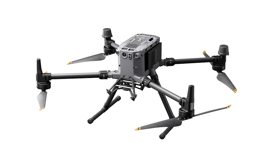
DJI Matrice 30
- IP55
- 41 min. maximale Flugzeit
- 15 m/s Windwiderstand
- 23 m/s max. Geschwindigkeit
- Zoom Kamera: 48 MP 1/2'' CMOS-Sensor, 5x-16x optischer Zoom, 200x Max. Hybrid-Zoom, Fotoauflösung: 8K, Video-Auflösung: 4K/30fps
- Laser-Entfernungsmesser: Bereich: 3 m - 1200 m, Genauigkeit: ±(0,2m+D×0,15%)6
- Nachtflug: Mit der FPV-Kamera, die für schwache Lichtverhältnisse optimiert ist, sind Boden und Silhouette auch bei Nacht deutlich zu erkennen
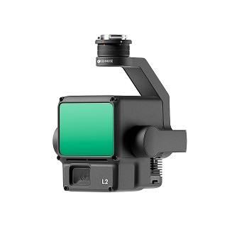
DJI Matrice 30T
- Wärmebildkamera: Äquivalente Brennweite: 40 mm, Auflösung: 640×512, Bildrate: 30fps Messgenauigkeit: ±2°C oder ±2%5
DJI FlyCart 30
DJI stellt die Lieferdrohne DJI FlyCart 30 (FC30) vor.
Die FlyCart 30 erledigt schwere Transportaufgaben bis zu 30kg sehr zuverlässig, bei einer maximalen Reichweite von 16km (28km im Leergewicht).
Neuste Sicherheitsfeatures wie Fallschirm oder Anti-Kollisionsradar sind mit on-board.

 image 1_EPOTRONIC")
 image 2_EPOTRONIC")


 image 1_EPOTRONIC")
 image 2_EPOTRONIC")
 image 1_EPOTRONIC")
 image 2_EPOTRONIC")
 image 1_EPOTRONIC")
 image 2_EPOTRONIC")
 image 1_EPOTRONIC")
 image 2_EPOTRONIC")


 image 1_EPOTRONIC")
 image 1_EPOTRONIC")
 image 2_EPOTRONIC")


 image 1_EPOTRONIC")
 image 2_EPOTRONIC")


 image 1_EPOTRONIC")
 PRO 5Stk. 50x50cm image 1_EPOTRONIC")
 PRO 5Stk. 50x50cm image 2_EPOTRONIC")


 Basic image 1_EPOTRONIC")


 image 1_EPOTRONIC")
 image 2_EPOTRONIC")


 image 1_EPOTRONIC")
 image 1_EPOTRONIC")
 image 1_EPOTRONIC")
 image 2_EPOTRONIC")


 image 1_EPOTRONIC")
 image 2_EPOTRONIC")
 image 1_EPOTRONIC")
 image 2_EPOTRONIC")
 image 1_EPOTRONIC")
 image 2_EPOTRONIC")


 image 1_EPOTRONIC")
 image 2_EPOTRONIC")