


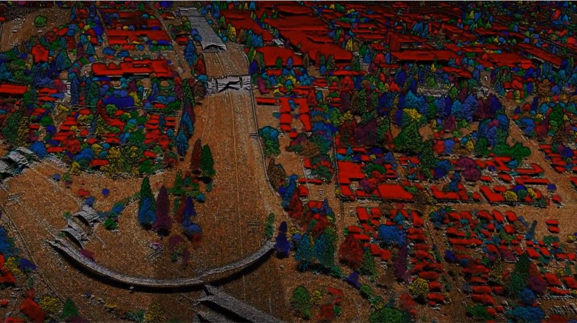
Vergleich des neuen LiDAR Scanner von DJI mit ausführlichen Testparametern. Beispieldatensatz auf Anfrage. Mehr Return-Signale, Dichtere Punktwolke, höhere Genauigkeit, bessere Reflexionsinformationen.
For drone projects that require more information from the data than is produced from standard processing, data analysis is required from post-processing tools and software.
Vergleich des neuen LiDAR Scanner von DJI mit ausführlichen Testparametern. Beispieldatensatz auf Anfrage. Mehr Return-Signale, Dichtere Punktwolke, höhere Genauigkeit, bessere Reflexionsinformationen.

04/09/2023
Besuchen Sie uns in Berlin vom 10.10.23 - 12.10.23. Wir stellen Ihnen gerne kostenlose Tickets zur Verfügung.

29/05/2023
Unser professionelles Team hat exklusiv einen virtuellen Rundgang und eine Punktwolke der Halle 13 (23.635m2) auf dem Messegelände Hannover mit einer Matterport Pro 3 für die Deutsche Messe AG aufgenommenen.
10/04/2023
Besuchen Sie uns auf der BAU in München
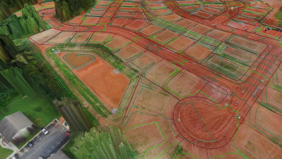
Using drones represents a big difference in the type of data used traditionally by surveyors. Virtual Surveyor incorporates traditional methods and deliverables to provide an intuitive experience for surveyors with little or no drone experience.


 image 1_EPOTRONIC")
 image 2_EPOTRONIC")
 image 1_EPOTRONIC")
 image 2_EPOTRONIC")


 image 1_EPOTRONIC")
 image 2_EPOTRONIC")


