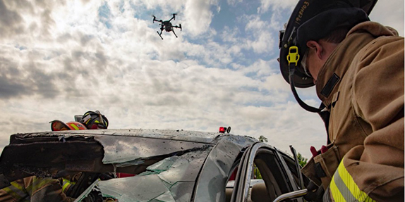
What sensors do drones use?
Drones are usually only useful when equipped with a sensor, which captures visual or other types of information of the surrounding area. There are a wide variety of sensors that drones use depending on the goal of the mission. This page gives an overview of the different sensors, what they are used for, and how to decide between them.


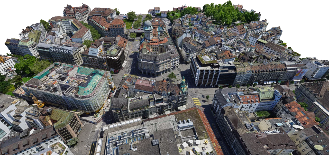
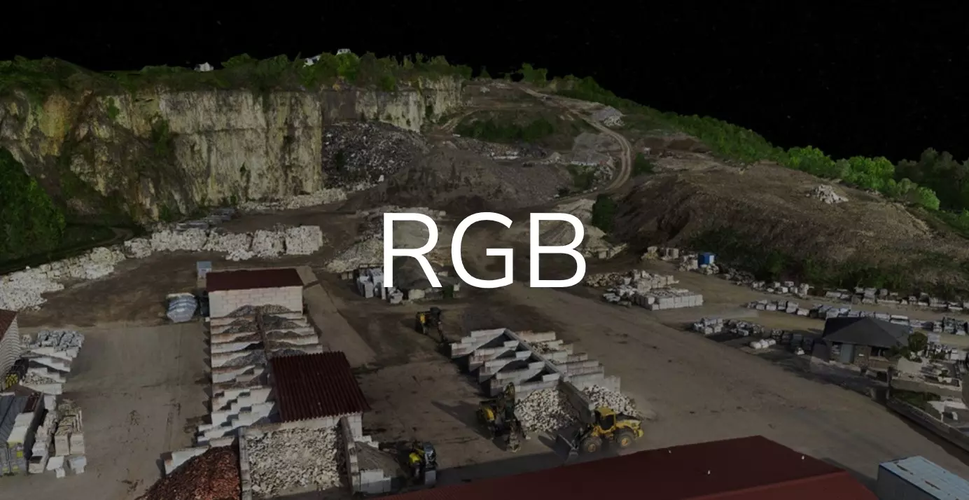
RGB
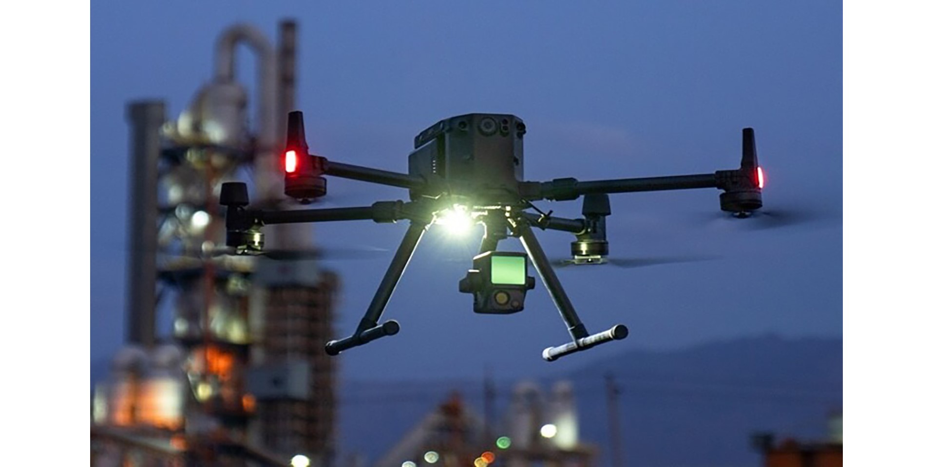
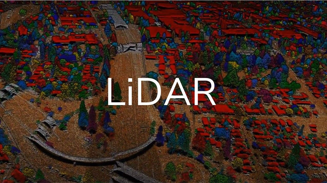
LiDAR
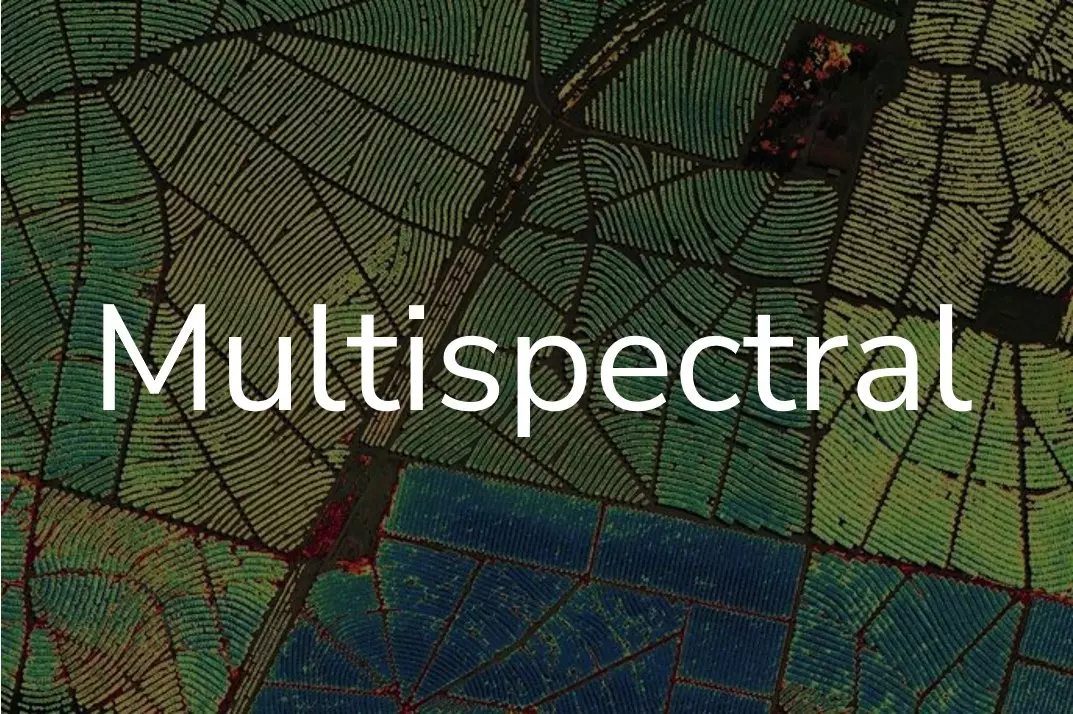
Multispektral
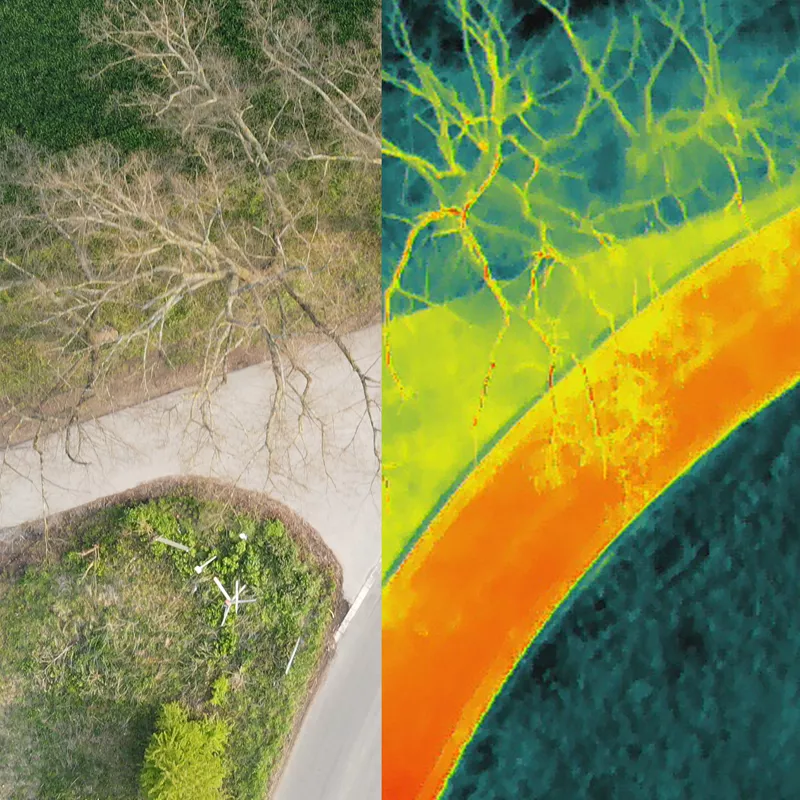
Thermographie
Mit Hilfe von thermographischen Sensoren kann die Strahlungsintensität von Wärmestrahlung an Oberflächen gemessen werden, wodurch sich die Oberflächentemperatur bestimmen lässt. Thermographische Sensoren werden im Regelfall in Multisensorsystemen zusammen im Tandem mit RGB-Sensoren eingesetzt, da die höhere räumliche und spektrale Auflösung der RGB-Sensoren die die Einordnung und Lokalisation der thermographisch erhobenen Oberflächen erleichtert.
Which sensor should you use?
The three sensors described above differ widely in their technology, although the main difference is when they are suitable to be used. This depends on the application but also the conditions of the drone flight e.g. weather conditions, and operational requirements or limitations.
Multispectral
Multispectral sensors are more specialist instruments that are mainly used in agriculture and research for in-depth analysis of crops, plant health, pollution detection, water quality analysis etc. To find out more about the use of multispectral sensors read our pages on this available at the following links: Precision Agriculture, Research and Development.
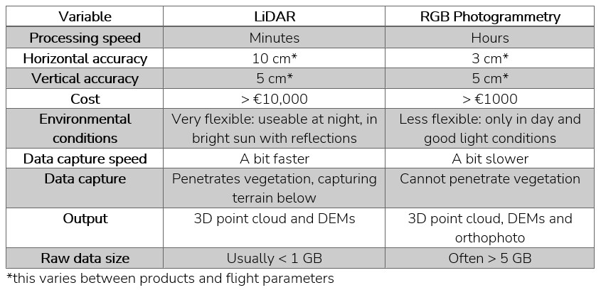
LiDAR vs RGB
The more difficult decision is deciding between RGB and LiDAR sensors. After all, they do essentially create almost all the same products, just by different methods. A table highlighting some of the main differences and similarities between these sensors is shown below.
As you can see in the table the main differences, are processing speed, environmental conditions usability, data size and cost. The accuracy is hard to put a number to so these figures should be taken with a pinch of salt.
The first step of making a decision is determining which sensors will be capable of capturing the required data. E.g if wanting to capture terrain beneath vegetation, only LiDAR will be suitable. If more than one sensor are still suitable, then you can look into cost, which is dependent on the cost of the product, as well as the time to capture and process the data.
Sometimes having both types of sensors can be the best option, as project requirements change over time. With modular drones such as the M300 RTK, different sensors types can be easily swapped, allowing you to undertake your work as efficiently as possible whilst retaiing quality.
Our recommendations
Below we list our top recommendations for each of the sensor types.
Thermographie
Further information
For further information on the industries and applications that can be benefitted by drones, read the pages linked below. For any further advice and information feel free to call us on +49 (0) 211 5 98929 10 or email us at info@epotronic.com.