Skip to main content Skip to search Skip to main navigation
Menu
Description

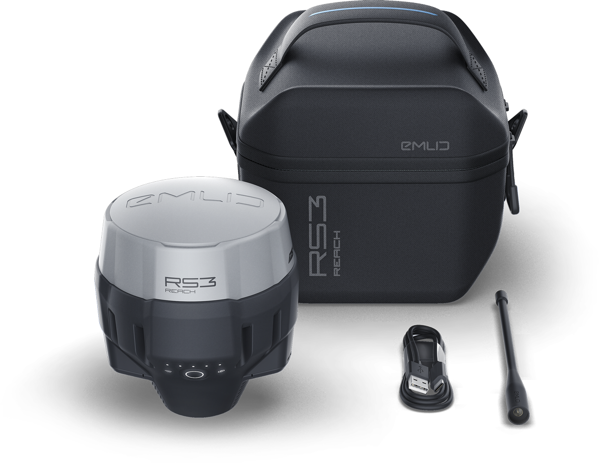
Emlid Reach RS3 Georeferenzierungs-Bundle


The complete package for the most efficient georeferencing of ground control points for your drone data and the provision of a local reference station.


Includes:

1x EMLID REACH Rs3 (Multi-Band RTK GNSS Receiver) incl. Li-Ion battery

1x Carrying case with a strap

1x Radio antenna

1x USB Type-C cable

5x Ground Control Points 50cmx50cm

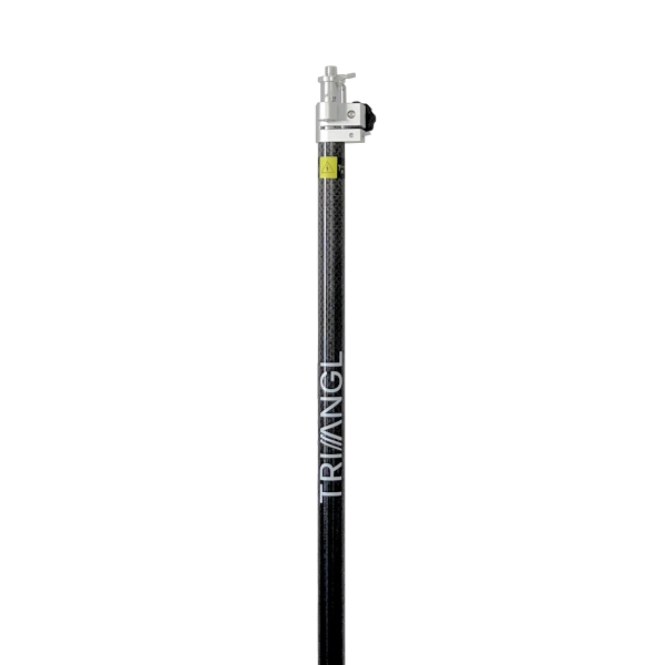
1x Triangl Carbon surveying Pole

1x Carrying Bag

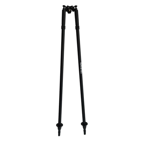
1x Triangl Bipod

1x Carrying Bag

Absolute accuracy: < 10mm, < 20mm, < 50mm, < 100mm
Application: BIM, Building insulation, Documentation, Inspection, Monitoring, Precision agriculture, Research &amp; Development, Surveying, Transport
Bundle: Ultra
Industry: Agriculture, Authority, Construction industry, Consumer, Energy grid operator, Fire brigade, Forestry, Large industrial plants, Long-distance supply, Military, Mining, Oil and gas, Police, Public utilities, Real estate, Solar systems, Universities, Wind turbines
Product type: Bundles, GNSS Rover, Surveying equipment
Relative accuracy / resolution: &lt; 5mm, &lt; 50 mm, < 10mm, < 20mm
Surveying tasks: 3D terrain model, Basic measurement, Building inventory, Construction supervision, Contour line model, DEM / DSM, Deformation lysis, Engineering surveying, Line documentation, Orthophotos, Pipe bridge documentation, Plant and building documentation , Plant area inventory, Plant measurement, Site plans &amp; plan bases, Steel construction measurement, Topographical as-built plan, Volume calculation


Delivery content

1x EMLID REACH Rs3 (Multi-Band RTK GNSS Receiver) incl. Li-Ion battery

1x Carrying case with a strap

1x Radio antenna

1x USB Type-C cable

5x Ground Control Points 50cmx50cm

1x Triangl Carbon surveying Pole

1x Carrying Bag

1x Triangl Bipod

1x Carrying Bag

Reviews
0

0 of 0 reviews

Average rating of 0 out of 5 stars

Leave a review!

Share your experiences with other customers.


Logos of DJI, Matterport, Phase One, GreenValley International, GeoCue, EMLID, and Virtual Surveyor

Günstigeren Preis gefunden?

Kein Problem. Wir sprechen gerne mit Ihnen über bessere Konditionen und überzeugen Sie von unserem Know-How, dass Ihnen ebenfalls weiterhelfen wird.

Miete, Leasing oder Pilotprojekt?

Bei uns können Sie testen bis es dunkel wird.
Nutzen Sie unsere Leasingoption für Ihre Steueroptimierung.
Ganz ohne Risiko starten Sie bei uns mit einem Pilotprojekt. Wir liefern Ihnen bereits vor Kauf nutzbare Ergebnisse und einen Mehrwert für Ihre Firma. Zusätzlich lernen Sie von uns gleich mit.

Sie benötigen überzeugende Demodaten?

Kontaktieren Sie uns und wir stellen Ihnen gerne einen Link zur Verfügung.

Referenzen benötigt?

Hier finden Sie eine kleine Auswahl unserer Referenzen.


info@epotronic.com  

+49 211 598929 11

Skip product gallery

Similar products

Tip
DJI Zenmuse P1 camera with gimbal for drones, ideal for professional aerial photography
DJI Zenmuse P1
DJI Zenmuse P1 Der neue Standard für Vermessungen aus der Luft Die Zenmuse P1 umfasst einen Vollformat-Sensor mit austauschbaren Objektiven mit fester Brennweite auf ein ...
VIRTUAL SURVEYOR Valley image 1_EPOTRONIC
Product Quantity: Enter the desired amount or use the buttons to increase or decrease the quantity.
VIRTUAL SURVEYOR Valley
From drone to CAD in a few clicks. Virtual Surveyor provides surveyors with an intuitive desktop software application, enabling them to rapidly create traditional surveyin ...
€0.00*
EPOTRONIC - Package - Theory + DJI Mavic 3 E + DJI Terra training image 1_EPOTRONIC
Product Quantity: Enter the desired amount or use the buttons to increase or decrease the quantity.
EPOTRONIC - Package - Theory + DJI Mavic 3 E + DJI Terra training
EPOTRONIC - Package - Theory + DJI Mavic 3 E + DJI Terra training Überblick Dieses Training bietet Ihnen einen sofortigen Einstieg in die Vermessung mit der DJI Mavic 3 E ...
€940.10*
EMLID Reach RS3 Survey Kit image 1_EPOTRONIC
Product Quantity: Enter the desired amount or use the buttons to increase or decrease the quantity.
EMLID Reach RS3 Survey Kit
EMLID Reach RS3 Survey Kit Das Kit besteht aus 2 Emlid Reach RS3 Zentimetergenaue Position Für Vermessung, Kartierung und Navigation Wird mit der Emlid Flow-App geliefer ...
€5,947.62*
EPOTRONIC Datenerhebung 1/2 Tag + Prozessierung Matterport Pro3
EPOTRONIC Datenerhebung 1/2 Tag + Prozessierung Matterport Pro3 Überblick: Luftgestützte Datenerhebung mittels ausgewähltem Sensor mit Genauigkeiten im Zentimeterbereich ...
EPOTRONIC - Support - Vermessungsprodukte image 1_EPOTRONIC
EPOTRONIC - Support - Vermessungsprodukte
EPOTRONIC - Support - Vermessungsprodukte Individueller Direktsupport durch unsere Mitarbeiter und Partner zu unseren Servicezeiten für 6 Monate und einem Kontingent von ...
EMLID Reach RX (RTK GNSS Rover) image 1_EPOTRONIC
Product Quantity: Enter the desired amount or use the buttons to increase or decrease the quantity.
EMLID Reach RX (RTK GNSS Rover)
EMLID Reach RX (RTK GNSS Rover) Netzwerk-Rover mit Zentimetergenauigkeit Taschenformatiger und leichter Rover für die Datenerfassung mit Zentimetergenauigkeit. Arbeitet m ...
€2,140.81*
EPOTRONIC - Datenberechnung image 1_EPOTRONIC
EPOTRONIC - Datenberechnung
EPOTRONIC - Datenberechnung Sie fliegen, wir berechnen. Nehmen Sie z.B. Bilder einer Dachfläche auf, um diese zu digitalisieren. 20 MP RGB Sensor max. 500 Bilder Date ...
EPOTRONIC data collection 1/2 day + processing DJI Matrice 350 + L2/P1
EPOTRONIC Datenerhebung 1/2 Tag + Prozessierung DJI Matrice 350 + L2/P1 Überblick: Luftgestützte Datenerhebung mittels ausgewähltem Sensor mit Genauigkeiten im Zentimeter ...
EPOTRONIC - Bodenkontrollpunkte (GCPs) PRO 5Stk. 50x50cm image 1_EPOTRONIC
EPOTRONIC - Bodenkontrollpunkte (GCPs) PRO 5Stk. 50x50cm
EPOTRONIC - Bodenkontrollpunkte (GCPs) PRO 5Stk. 50x50cm Dieses Set beinhaltet 5 Bodenkontrollpunkte in einem Schachbrettmuster aus hochwertigem, festen und leichtem Alum ...
GREENVALLEY LiAir X3-H + Camera + LiGeoreference image 1_EPOTRONIC
Product Quantity: Enter the desired amount or use the buttons to increase or decrease the quantity.
GREENVALLEY LiAir X3-H + Camera + LiGeoreference
GREENVALLEY LiAir X3-H + Camera + LiGeoreference Genauigkeitsbereich: ± 2cm (1σ@20m) Gewicht: 1.25kg (einschl. Kamera) Scanbereich: 190m @ 10% Reflexionsgrad 450m @ 80% ...
€10,426.66*
EPOTRONIC - Vermessungspauschale M350 + L2 - inkl. Pilot (1/2 Tag) image 1_EPOTRONIC
EPOTRONIC - Vermessungspauschale M350 + L2 - inkl. Pilot (1/2 Tag)
EPOTRONIC - Vermessungspauschale M350 + L2 - inkl. Pilot (1/2 Tag) Luftgestützte Datenerhebung mittels DJI M350 und DJI Zenmuse L2. Die Ergebnisse der Befliegung sind ein ...
Skip product gallery

Customers also viewed

Tip
DJI Matrice 4E Enterprise Worry-Free Plus Combo
DJI Matrice 4E Die DJI Matrice 4 Serie ist eine neue Generation von kleinen intelligenten Multi-Light-Flaggschiff-Drohnen für Unternehmen, die einen neuen Maßstab für int ...
€4,523.00*
New
DJI Matrice 4TD - RC Plus 2 Enterprise Combo (inkl. 12 Monate DJI Care Enterprise Plus, ohne Akku) image 1_EPOTRONIC
Product Quantity: Enter the desired amount or use the buttons to increase or decrease the quantity.
DJI Matrice 4TD - RC Plus 2 Enterprise Combo (inkl. 12 Monate DJI Care Enterprise Plus, ohne Akku)
DJI Matrice 4TD - RC Plus 2 Enterprise Combo (inkl. 12 Monate DJI Care Enterprise Plus, ohne Akku) ...
€8,685.00*
EMLID Reach RS3 Survey Kit image 1_EPOTRONIC
Product Quantity: Enter the desired amount or use the buttons to increase or decrease the quantity.
EMLID Reach RS3 Survey Kit
EMLID Reach RS3 Survey Kit Das Kit besteht aus 2 Emlid Reach RS3 Zentimetergenaue Position Für Vermessung, Kartierung und Navigation Wird mit der Emlid Flow-App geliefer ...
€5,947.62*
Ihre Fragen direkt beantwortet: