

GreenValley International
GreenValley International (GVI) offers advanced but easy-to-use laser scanning technologies from the air, from the ground and from mobile devices. The extensive product line includes several high-precision 3D mapping hardware solutions and software solutions.
LiAir 220N

LiAir 220N
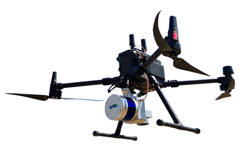
LiAir V70
UAV or sUAS based LiDAR survey instrument developed with DJI's Matrice 300 RTK and 600pro flight platforms in mind. The sensor is GreenValley's lightest and cheapest, stripped down to the essentials for accurate lidar surveying. Combined with the user-friendly software options shown below, results can be achieved with vertical accuracy of up to 4-5 cm.
Data Sheet User Guide Sample Data

LiAir 250 Pro


LiGeoreference
Proprietary software that allows users to convert distance measurements and POS data from mobile, UAV or airborne laser scanner systems into georeferenced coordinates. Post-processing options such as flight strip calibration, GCP accuracy adjustment and estimation, and quality analysis are also possible.
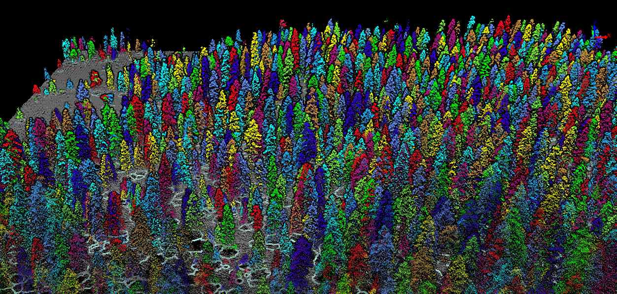
LiDAR360
A very intuitive software for a large range of analysis tools. Included are classification tools for point clouds, including ingenious machine learning classification, and automatic ground point classificiation. Terrain outputs such as DEMs, DSMs, TINs and contours can be flexibly created. Point clouds can be normalized (flattened) and a large range of forest analyses can be undertaken such as tree segmentation.
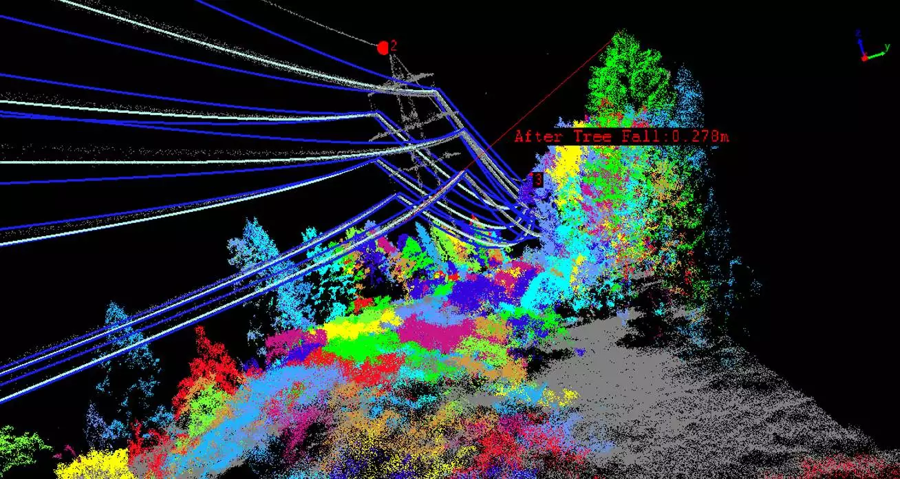
LiPowerline


 image 1_EPOTRONIC")
 image 2_EPOTRONIC")
 image 1_EPOTRONIC")
 image 2_EPOTRONIC")


 image 1_EPOTRONIC")
 image 2_EPOTRONIC")


