Survey with drones with Virtual Surveyor
From drone to CAD in a few clicks
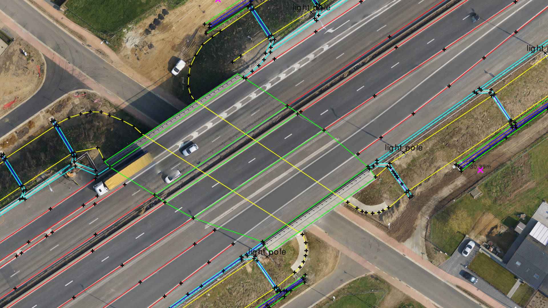
Using drones represents a big difference in the type of data used traditionally by surveyors. Virtual Surveyor incorporates traditional methods and deliverables to provide an intuitive experience for surveyors with little or no drone expereince.
Virtual Surveyor works with point clouds, orthophotos and elevation models generated by drones to create deliverables traditionally created by surveyors.
Combine the power of your brain to interpret complex topographies with the calculation power of the computer to create drone surveys in very short times.
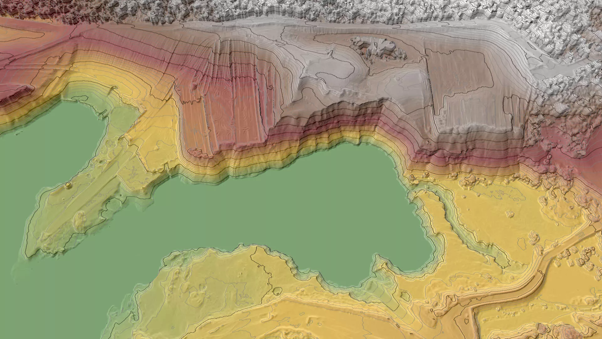
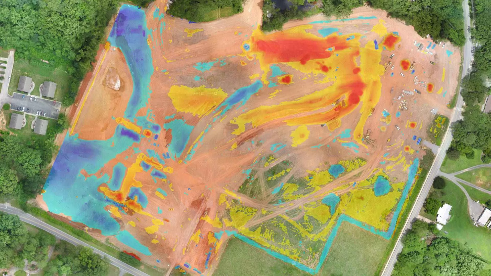
Use drone data for a more efficient and safer mine management. Create more accurate reports on excavations and stocks. Bridge the gap with your specialized mining software.
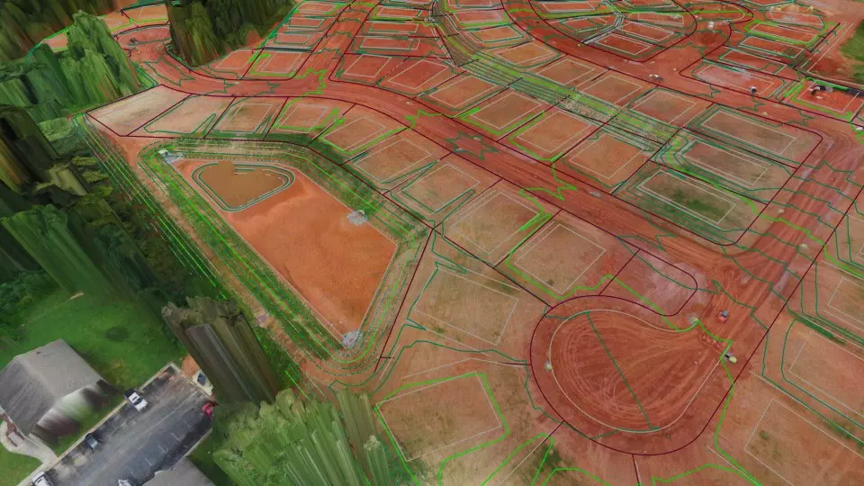
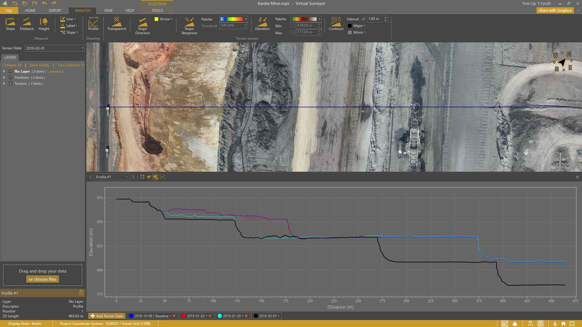
Keep track of your construction project with multiple drone surveys. Compare with your baseline or design surface and determine how much work needs to be done.
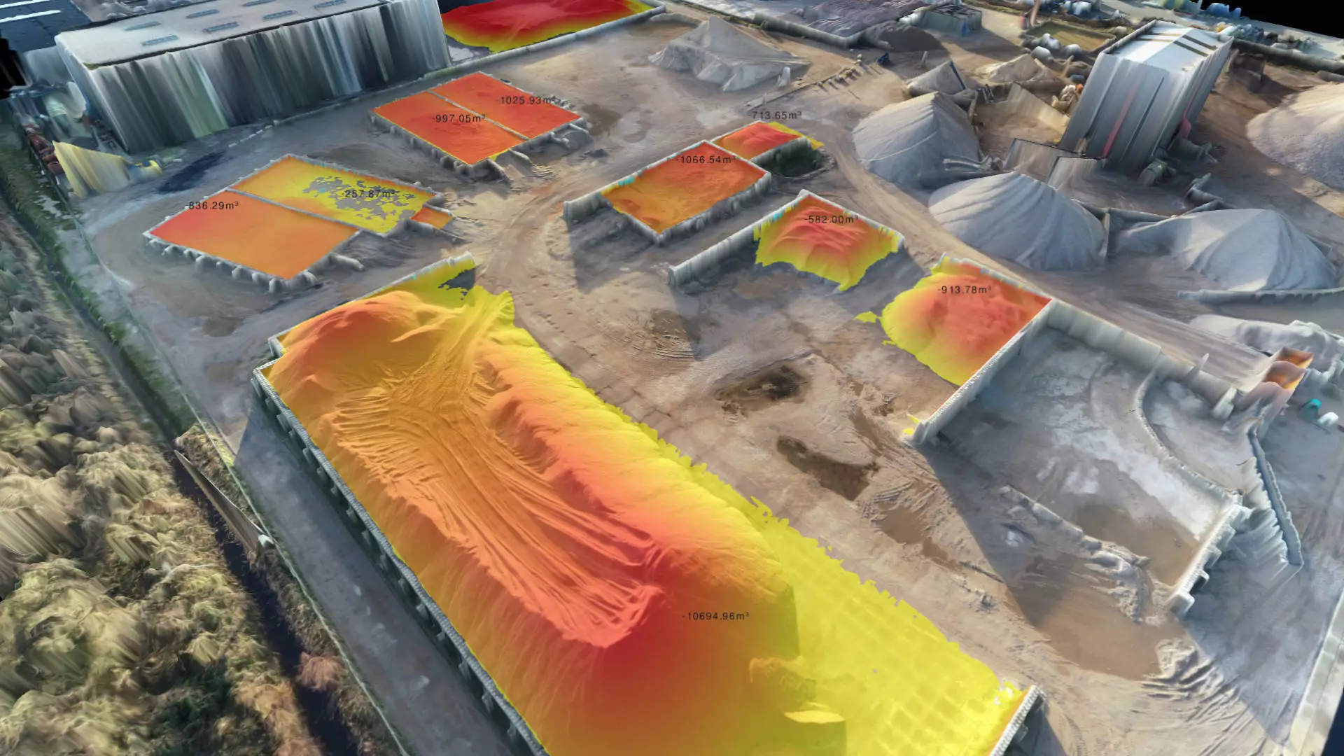
Know the true value of your stocks with drone data. Set materials, calculate volumes, tonnages and monetary value for a single project or over time.
Combine data from drones, field work and CAD
Sometimes drone data is the only data source you need. Often, it is not. Add data from your field instruments (GPS or total station) to capture topographic features that cannot be observed from drones. Import civil designs from CAD and compare them with your drone data.
Orthophotos
Point Clouds to DSM
Field Surveys
Digital Surface Models
Point Clouds to Ortho
DXF/LandXML files
Features
Virtual Surveyor contains a large array of features, ensuring the surveyor can get the results they need.
Survey Tools
- Points with elevations and annotations
- Polylines and boundaries
- Semi-automated breaklines
- Regular point grids e.g. spot heights
- Automatic contour and TIN generation
- Import field measurements to assess the accuracy of the drone data
- Points with elevations and annotations
- Polylines and boundaries
- Semi-automated breaklines
- Regular point grids e.g. spot heights
- Automatic contour and TIN generation
- Import field measurements to assess the accuracy of the drone data
Volume Tools
- Stockpile and basin fill volumes
- Volume annotations and export
- Cut and fill analysis
- Export cut and fill maps and create reports
- Remove ground equipment from volume calculation
Other Tools
- Compare terrain over time or to the design with the profile tool
- Clip and stitch together orthophotos
- Flatten water bodies or other areas to a reference plane
- Simulate water flow direction and create a water surface
Teamwork
- Collaborate on projects using the seamless integrated Dropbox tool
- Save a project to the shared drive allowing access to colleagues
- Access projects from anywhere
- All updates are added to the single project ensuring everyone is seeing the most up to date version
- If two people have the project open at the same time, one will be in read-only mode while the other makes edits.