

Energy Supply
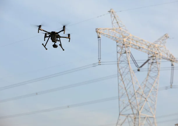
Drones have the potential to revolutionise inspection and surveying missions in the energy industry. Drones can drastically reduce the time and manpower required to map energy assets, whilst still providing high quality and reliable data.
Powerline Inspection
Powerlines require regular inspection to ensure that they continue to operate safely and effectively.
Vegetation Management
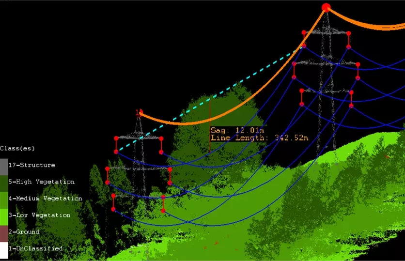
When trees grow near or beneath a high-voltage transmission line, the space between the conductors and some branches can get dangerously close. Such a tree must be taken down to avoid a short circuit, which could result in a blackout and possibly a fire. Therefore, the transmission lines must be regularly visually checked, which is usually done with on the ground teams or a helicopter. From this monitoring, critical areas can be identified. However, more investigation is required to determine whether trees must be cut down.
It's difficult to determine the distance between the conductors and the branches from the ground. A common solution for this is to have workers climb onto the transmission line after it is turned off, to take a manual measurement. However, this is very expensive, as well as dangerous.
Undertaking laser measurements from a helicopter is unsuitable as to ensure that all branches are detected, it must fly close to the trees, however, the downdraft from the helicopter pushes the branches away, leading to an underestimated measurement. Chopping simply all trees under a transmission line, which was done in former times, is not a desirable solution for environmental and economic reasons.
The solution
To make significant savings in labour, time and expense, it is now possible to inspect powerlines for vegetation encroachment with UAV LiDAR. When well-planned and properly executed, this solution is able to produce results that are arguably more accurate than has ever been possible before.
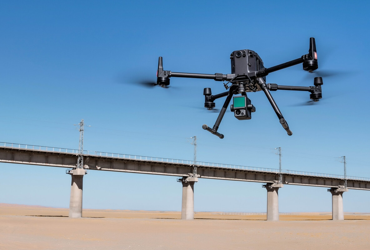
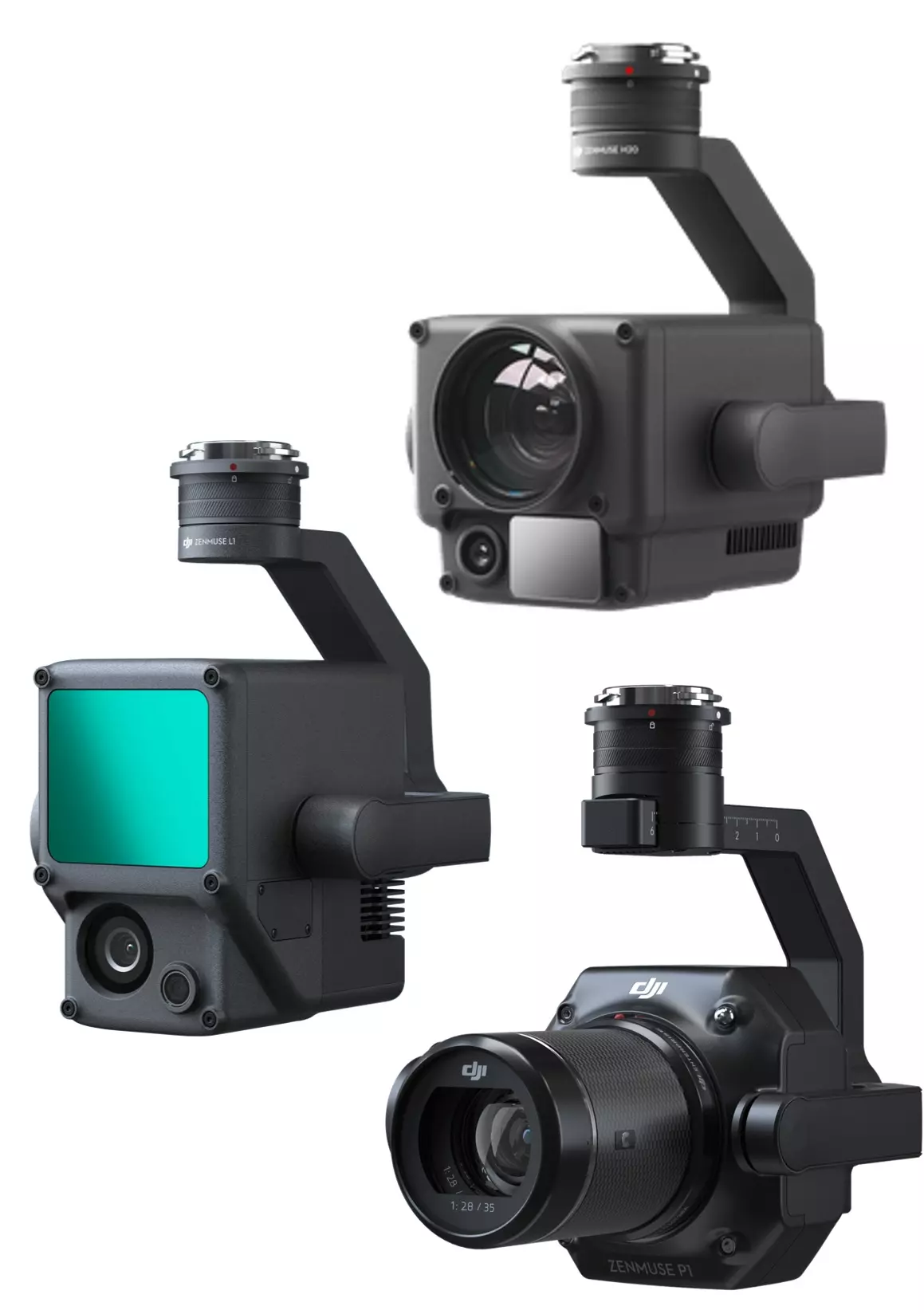
The DJI M300 RTK is a lightweight UAV designed for protection against electromagnetic interference (EMI) with its dual RTK antenna system that allows for a sustained stable and precise flight even near operating powerlines. Along with its 40 minute flight time with payload, it is the perfect tool for the job. The Green Valley International (GVI) LiAir V70 lidar scanner is easily mounted to the M300, and can record 240,000 points per second with 5 cm precision. Used in conjunction, and with automatic flight planning (available from UgCS or DJI Pilot), this results in a highly efficient and accurate model of the powerline structures and surrounding landscape. DJI have also released their own lidar sensor, the Zenmuse L1, which uses the same LiVOX Avia sensor as the V70. This integrates seamlessly into the workflow, in combination with DJI Terra, which can easily process and georeference the lidar data into an exportable LAS or LAZ file for post-processing.
Data inspection is made seamless with the specifically designed software from GVI: LiPowerline. LiPowerline offers many powerful tools for analysis of vegetation encroachment. This includes danger point detection, which, combined with point cloud classification, highlights all vegetation-represented points that exceed the distance threshold to the conductor cables.
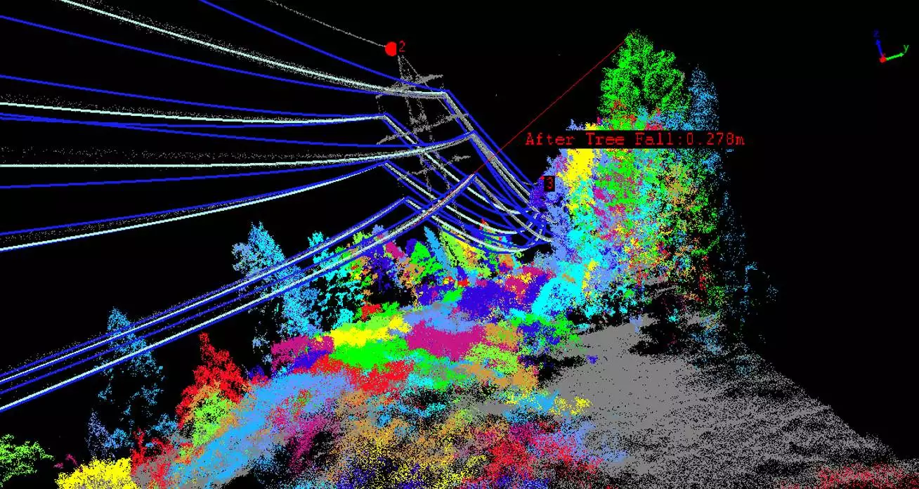
Due to bad weather conditions including rain, wind and storm, etc., these vegetations can also strike the power line sag, or sometimes hot weather can also result in more sagging of the transmission lines. This can also be achieved under various simulated environmental conditions, including temperature and wind and ice-loading, which affect the sag and sway of the cables. Early warning analysis can also be employed by, first, simulating vegetation growth rate, thereby estimating when the vegetation will exceed the danger threshold, and second, simulating the fall of individual trees, to detect which would potentially enter the danger zone. As an output, printable documents can be produced for delivery to vegetation mangers, utility foresters, and arborists who maintain grid reliability and public safety, to allow them to carry out the necessary work at the correct place.
Mast Inspection
As well as vegetation encroachment monitoring, the powerline towers themselves need to be regularly inspected. This means damaged or faulty parts can be identified before they cause an issue, such as a power outage or fire. In addition, if a fault does occur spontaneously, it is critical to identify and solve the problem as quickly as possible.
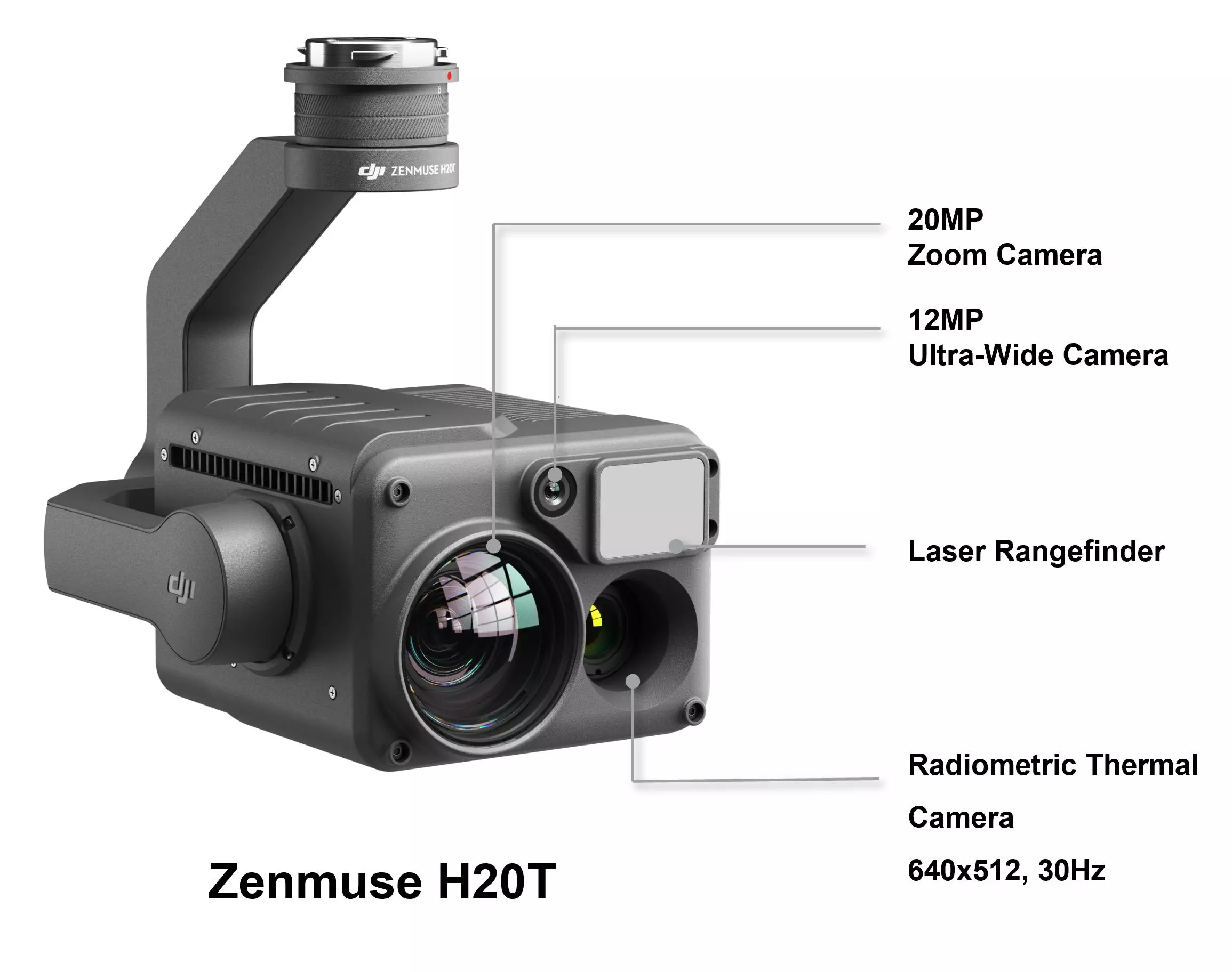
Traditional methods to identify powerline faults are labour-intensive, time-consuming, and often dangerous. With the DJI M300 RTK equipped with the H20T, it has never been easier nor more efficient to identify issues. The H20T has a 23x zoom 20MP RGB camera with laser rangefinder as well as a thermal camera, to ensure all issues are detected, such as corrosion, mechanical damage, and electric faults.
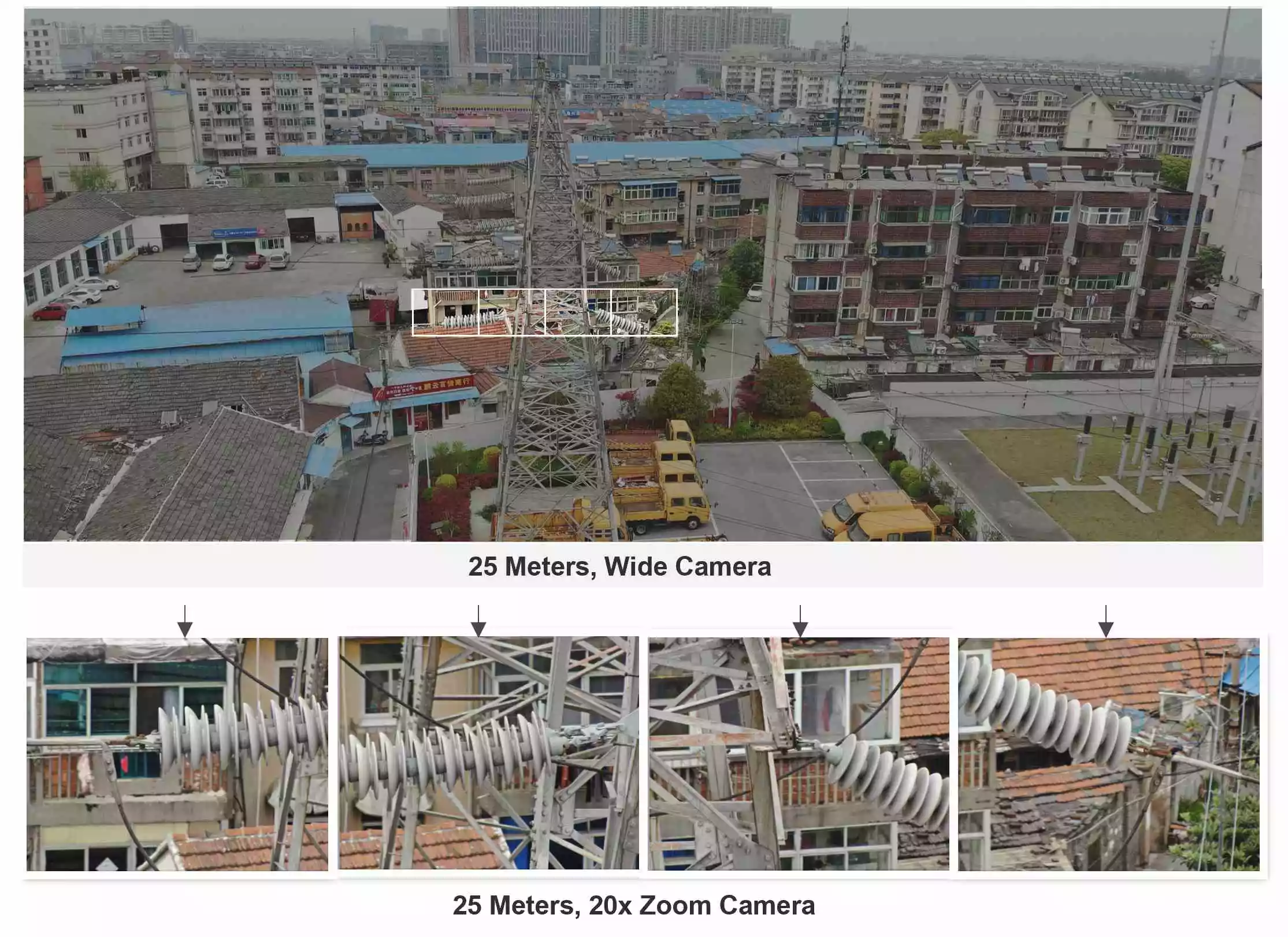
H20 high res-grid photo
High-res grid photo can frame an area of interest in wide camera view, and the zoom camera will automatically capture a set of 20 MP images of the area. These images are stored together with an overview image that can be viewed in greater detail.
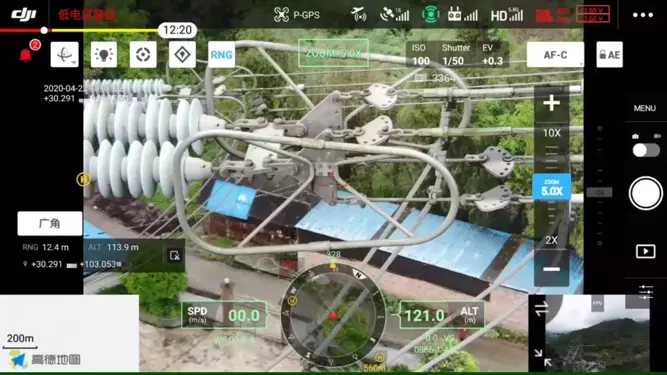
H20 Smart Track
Smart track provides an ability of M300 RTK and H20 series is able to track stationary subjects. An auto-zoom function helps to keep the subject centered in the frame for optimal viewing to meet multi-angle inspection without blind spot.
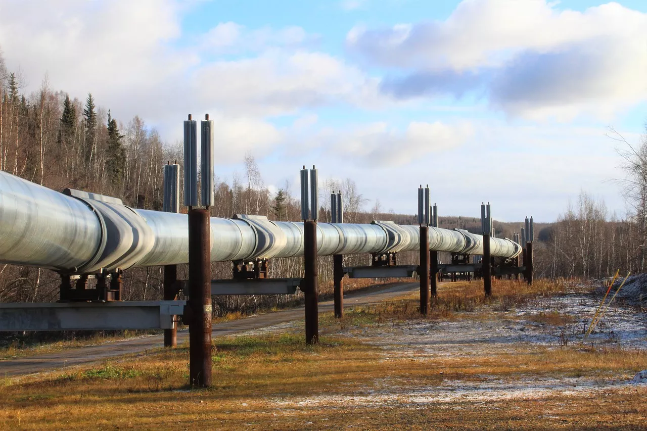
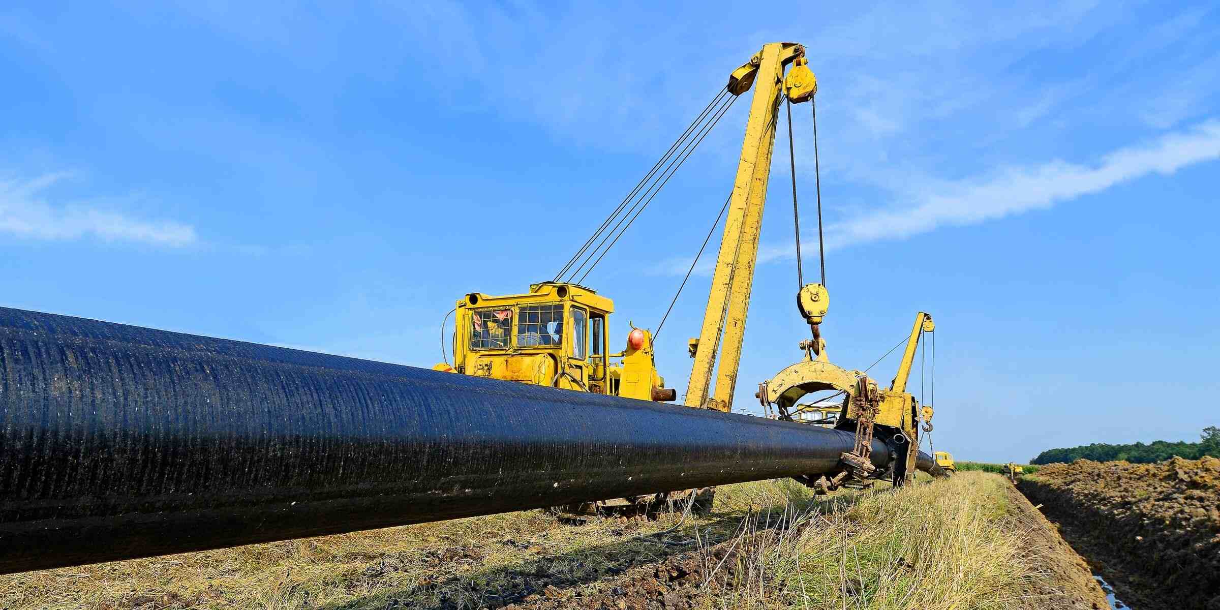
Pipeline Inspection
Whether underground or overground, drones can offer time and cost savings for pipeline inspection, whilst maintaining high quality work.
Inspection
Land and vegetation monitoring


 Basic image 1_EPOTRONIC")


 image 1_EPOTRONIC")
 image 2_EPOTRONIC")
