


Vermessungsdienstleistungen

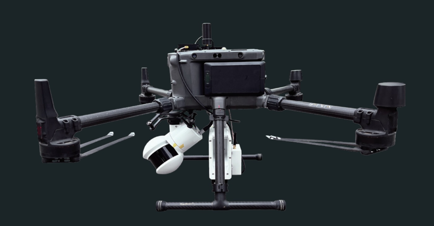
Vermessung mit Laserscanner oder RGB-Sensor
Effektive und schnelle Erstellung von kolorierten Punktwolken
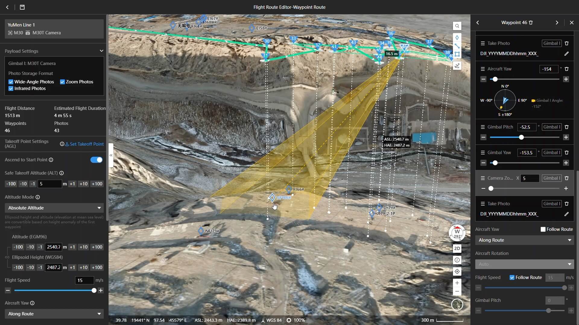
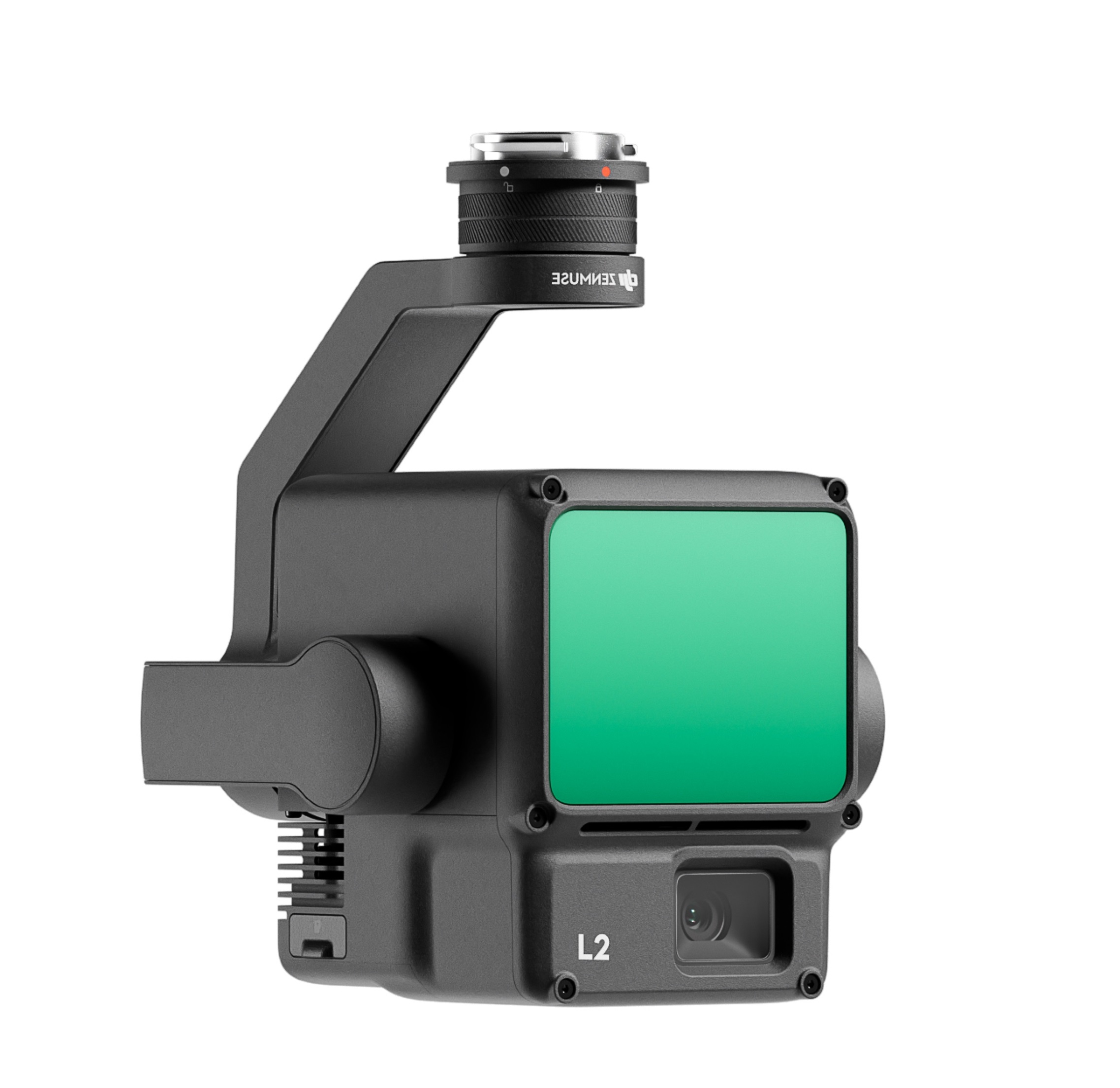
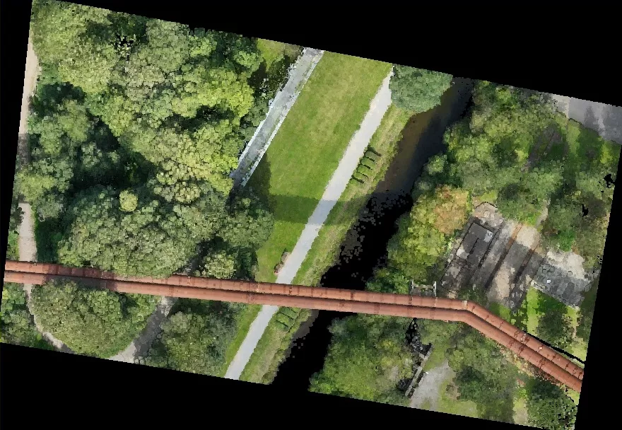
Hier ist ein typischer Verarbeitungsworkflow zur Erstellung eines digitalen Geländemodells (DEM) dargestellt. Ausgangspunkt ist die Aufnahme einer kolorierten Punktwolke, aufgenommen mit einem System bestehend aus der DJI M350 als Trägerplattform und der DJI Zenmuse L2 als Laserscanner. Die Punktwolke links im Bild wurde um Fehlpunkte bereinigt und die Georeferenzierung optimiert.
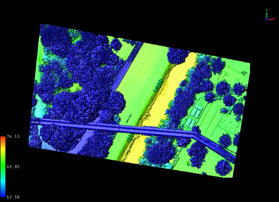
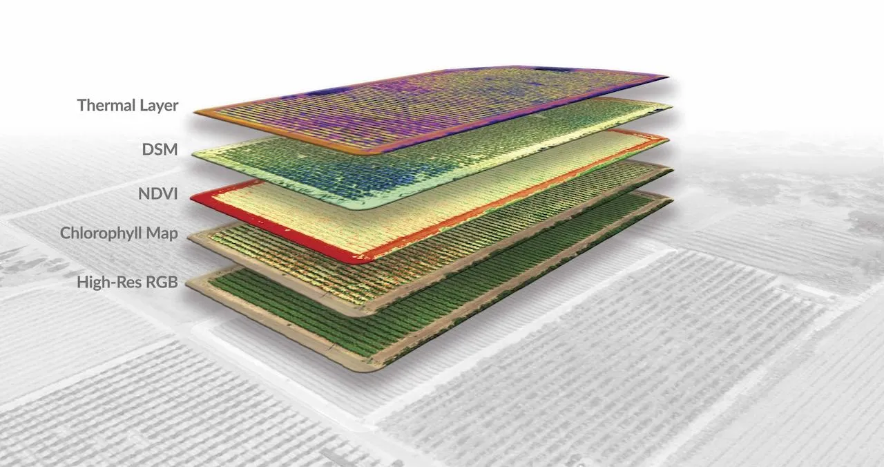
Punktwolke mit Höhenkolorierung
Schematische Kolorierung der Punktwolke für eine effiziente Datenauswertung.
Über die Analyse der z-Achse lässt sich in Sekundenschnelle eine effektive Aussage des Höhenreliefs erstellen. Die höchsten Punkte sind hier dunkelblau dargestellt und die niedrigsten gelb. Diese Informationsdarstellung nennt sich digitales Oberflächenmodell (DOM); engl. digital surface model (DSM).
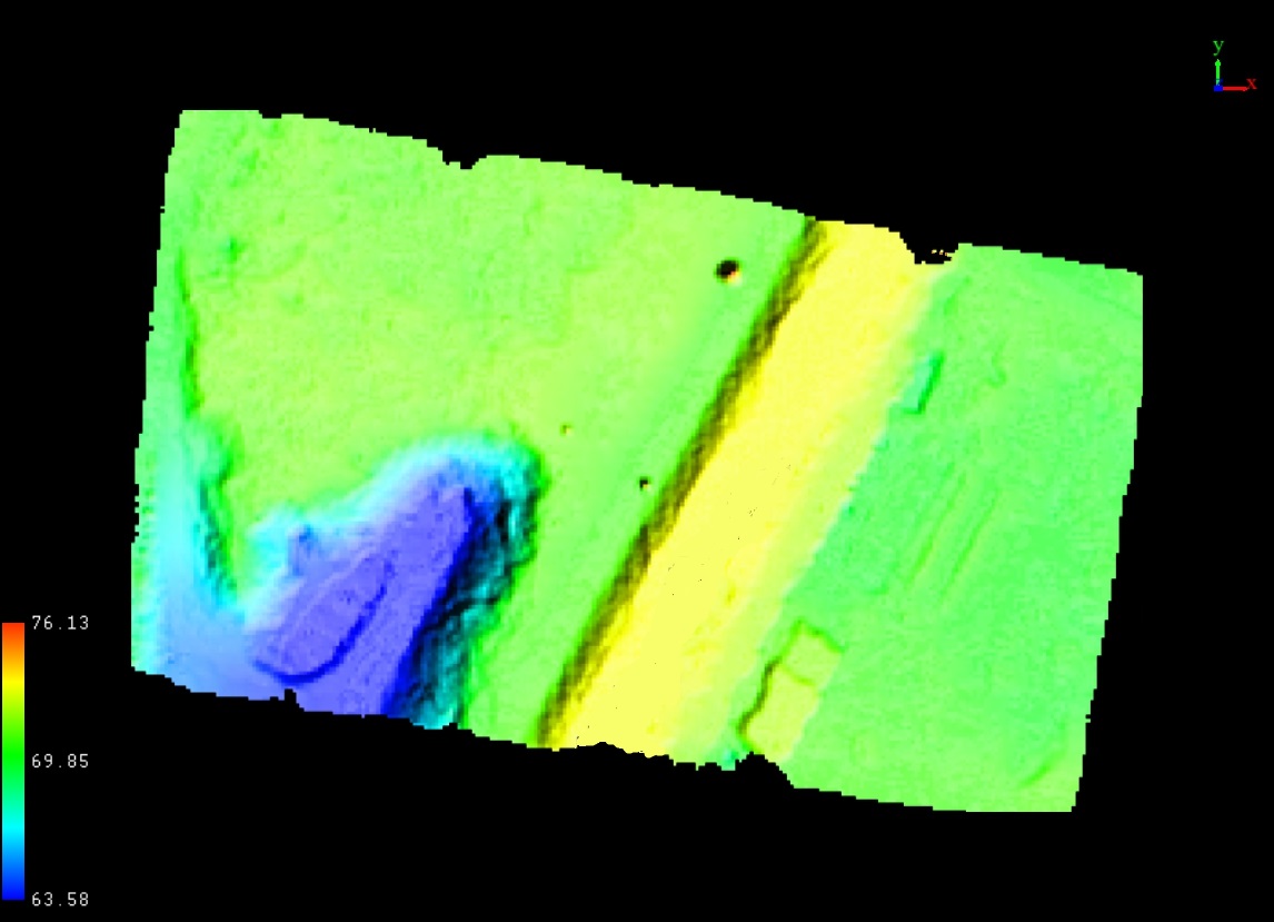
Automatische Bereinigung der Punktwolke um Oberflächenstrukturen
Mit Hilfe von Machine-Learning-Algorithmen in Programmen wie der LiAir-Software-Suite von GreenValleyInternational oder VirtualSurveyor können die Daten schnell und effizient bereinigt und ausgewertet werden. Beispielsweise in dem man automatisiert die Oberflächenstrukturen aus der Punktwolke entfernen lässt, um ein digitales Geländemodell (DGM) zu erstellen; engl. digital elevation model (DEM).
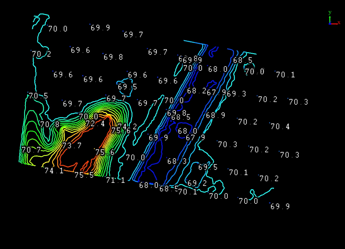
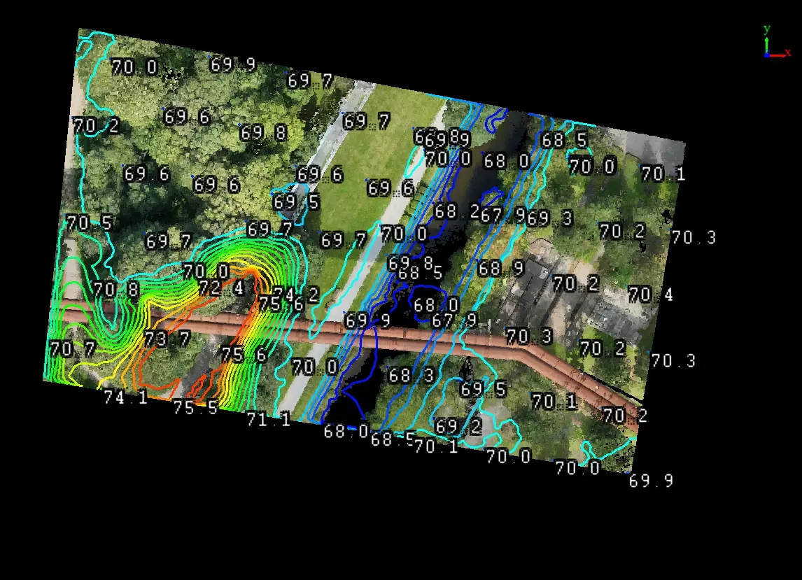
Erstellung einer Höhenkartierung
Mit wenigen Klicks können aus der bereinigten und georeferenzierten Punktwolke Höhenlinien erstellt werden.
Anreicherung des Ursprungsdatensatzes um Zusatzinformationen
RGB-basiert
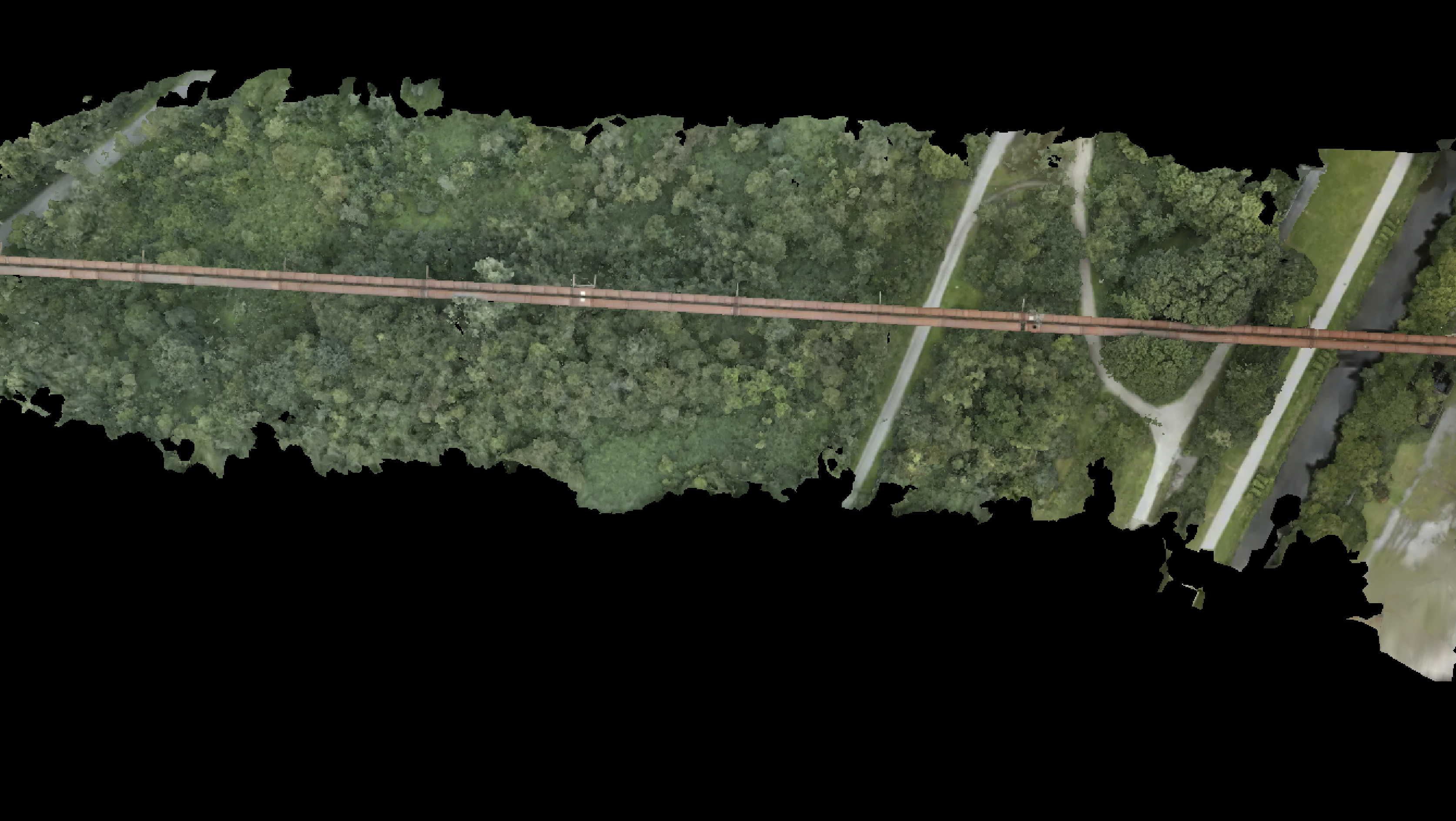
Orthofotos, die aus drohnengestützten RGB-Daten generiert werden, haben viele Vorteile:
Eine hohe Auflösung, einfache Visualisierung durch 3D-Modelle, sowie geringe Anfangsinvestitionen in Hardware und Software.
Als Output können Orthofotokartierungen, Punktwolken, DGM/DEM oder DOM/DSM und 3D-Modelle generiert werden. Die dafür eingesetzten UAS sind meist kleiner als die Modelle mit Laserscanner, der genehmigungsrechtliche Aufwand ist dadurch vielfach geringer.
Die Präzision ist vergleichbar zu LiDAR-Scannern im unteren bis mittleren Preissegment.
Vegetation kann nicht durchdrungen werden, die automatisierte Erstellung von DEMs ist daher in Gebieten mit hoher Vegetationsdichte nicht ratsam.

LIDAR-basiert
LiDAR-basierte Drohnenvermessungen generieren als Produkt immer eine Punktwolke. Diese kann im Nachgang zu einem 3D-Modell oder DEM / DSM-Daten verarbeitet werden.
Großer Vorteil von LiDAR-Daten ist die Vegetationsdurchdringung des LiDAR-Sensors, wodurch sich luftgestützte LiDAR-Daten für DEM-Erstellung in bewachsenen Bereichen besonders gut eignen.
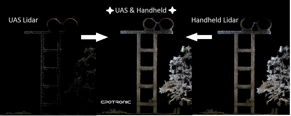
Kombinierte Vermessungsansätze aus luft- und bodengestützen LiDAR-Daten
Zur effektiven Vermessung von Bereichen, die aus der Luft nicht einsichtig sind, können Handheld- oder terrestrische LiDAR-Systeme (z.B. LiGrip von GreenValleyInternational) mit luftgestützten Systemen (z.B. DJI Zenmuse L2) kombiniert werden. So können Punktwolken um Unterseiten und Innenräume von Strukturen, Gebäuden und Anlagen ergänzt werden.