

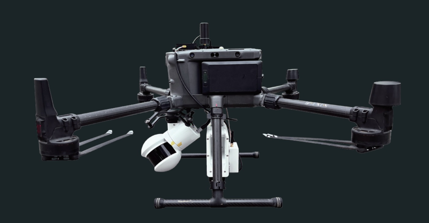

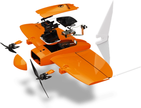
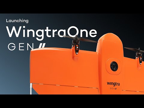
WingtraOne Gen II
VTOL-Drone of the next generation

WingtraOne GEN II listed as Blue sUAS by US DIU, pre-approved for use by government agencies
Wingtra, developer of industry-leading VTOL survey and mapping drone technology, announced that its WingtraOne GEN II (2022) drone has been approved as the only VTOL mapping solution among a total of 14 UAVs on the Blue UAS Cleared List under the US Defense Innovation.
Blue sUAS 2.0 Program
The Blue UAS list is short and showcases the most trusted, safe and effective drone technology the U.S. could find," said Vaibhav Sawhney, product manager at Wingtra. We are honored to make the list and motivated to continue developing a system that will be beneficial for complex surveying and mapping missions for government operations.


Wingtra One RX1R II
- 42MP Kamera
- 110 ha (272 ac)
Other Fixed-Wing-Drones
- 20MP Kamera
- 70 ha (173 ac)
Multicopter-Drones
- 20 MP Kamera
- 8 ha (20 ac)


Maximum availability
WingtraOne GEN II offers the most advanced reliability in survey drones. This is key to maximizing drone uptime, increasing your productivity and ensuring you deliver consistently.
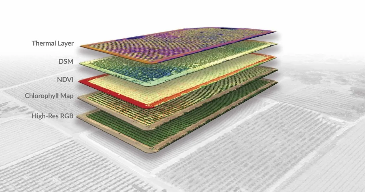
One drone to map it all
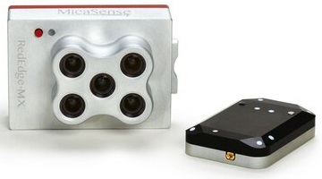
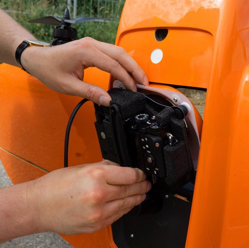
The payload range now includes an oblique camera for the most detailed 3D reconstruction and an integrated PPK GNSS receiver for each camera, so you can take on a wider range of missions with centimeter-level accuracy.
Software for a smooth workflow
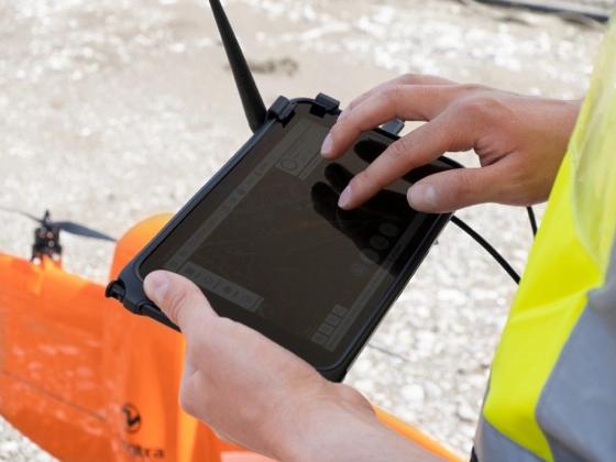
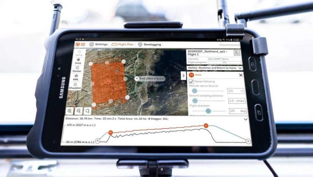
WingtraOne comes with a rugged tablet and a feature-rich, easy-to-use flight planning app, so you can have a successful data collection experience from day one.
Ready to fly in five minutes
The WingtraOne drone comes with a tablet with WingtraPilot, the built-in app for easy data collection management. The intuitive app offers several ways to prepare flight plans and monitor and review missions in flight.
5 minute setup
Take off in less than five minutes, including drone setup, all pre-flight steps, and planning a simple mapping mission.
Pre-flight checklist
WingtraPilot ensures the drone is fully functional before flight by performing background checks such as battery health, GPS reception, and test images.
Fully autonomous
Automated takeoff, in-flight data collection and landing without human interaction.
Manual takeover with in-app control
Take manual control of the drone at any time during landing. Use the intuitive controls on the tablet to adjust its position in the air and land safely.
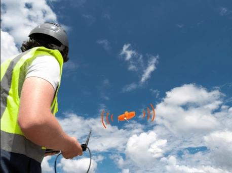
Real-time monitoring
Displays information such as flight location, altitude and mission progress from up to 10 km (6 miles) away.
Intelligent voice
Provides you with comprehensive audio feedback during the mission.
Video
Up to 59 minutes of flight time
The efficient fixed-wing flight mode allows WingtraOne to take on missions that last up to 59 minutes.
10 km telemetry range
Stay in touch with your drone over a direct range of up to 10 km (6 miles).
Remote ID ready
The WingtraOne GEN II is equipped with a WiFi module that ensures full compliance with existing and upcoming remote ID regulations.
2 x 2 m landing accuracy (6.6 x 6.6 ft).
WingtraOne lands exactly where it took off, allowing you to operate in tight spaces and increase the overall safety of your flight.
Sharp results in strong winds
Advanced wind control algorithms ensure stable data collection in sustained winds up to 12 m/s (27 mph) and gusts up to 18 m/s (40 mph).
GNSS receiver with four constellations
Redundant modules with GPS (L1, L2), GLONASS (L1, L2), Galileo (L1) and BeiDou (L1).
Altitude propeller
Optional propellers allow launch at altitudes up to 4800 m (15,700 ft) AMSL and data collection at altitudes up to 5000 m (16,400 ft) AMSL.
Corridor mapping
Fast, efficient coverage of long, narrow routes. For road construction or inspection; inspection of railroad tracks, pipelines, and power lines; and environmental research.
Stay confident even in difficult conditions
Developed in Switzerland, WingtraOne offers the highest quality standards and is used extensively in a variety of environments, from glaciers in Greenland to desert mines in Namibia.
Fly safely anywhere
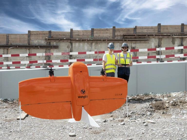
WingtraOne can take off and land anywhere - even in tight spaces or rough terrain. This allows you to collect data where other drones can't. Plus, vertical landings mean no dirt to scratch your camera lens, and therefore longer equipment life.
Further Videos

Technical Specifikations WingtraOne Gen II
Case Study
Dubai
Dubai surveying company benefits from business gains thanks to WingtraOne reliability
Dubai is a shining showcase of architectural and construction ambitions. New skyscrapers, islands and/or attractions pop up along its skyline every year. It's impossible to track developments and manage vertical real estate from the ground. So it's no wonder that one of the city's leading surveying companies,GEOTECH 3D, has turned to drones since they just emerged as mapping solutions in 2014. In 2017 they started mapping with SenseFly drones, and over the next few years they did it a large fleet.


"So SenseFly was a nice experience because it gave us the advantage of collecting huge amounts of data," said Walid El Hajj, technical director at GEOTECH 3D." It was good at the time."
In 2018, the company bought a VTOL from a Chinese company. But it didn't work because Dubai's desert climate is extreme for some systems. The team "sent the drone for repair, and when it was opened, it was full of sand," El Hajj explained.
Applications in your industry
Learn more about how survey professionals in your industry have used WingtraOne to improve decisions and reduce costs.


Surveying and GIS
- Land survey
- Cadastral maps
- Topographic Surveys
- Precise Measurements
- Land management and development
- Urban Planning
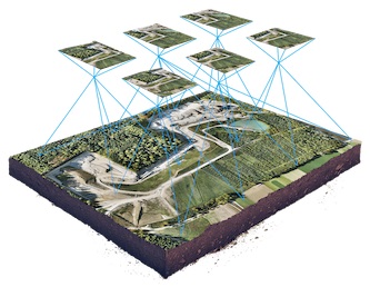
Drone technology represents tremendous potential for surveyors and GIS professionals. It significantly reduces the cost and man-hours of data collection. In addition, you can survey otherwise inaccessible areas and provide high-resolution aerial maps, which could not be produced safely or cost-effectively by other means.
Mining and aggregates
- Inventory and management of stockpile volumes
- Monitoring of mines or quarries and operational planning
- Assessment before drilling or blasting
- Monitoring of roads
- Monitoring of slopes
- Identification of hazards
Improve the efficiency of managing large mines and quarries by providing complete data on the condition of the site in a short time. Data can be created safely by workers on site without the risk of climbing stockpiles or walking amidst moving construction equipment. All this at a fraction of the cost of traditional surveying methods and without disrupting machinery.
Construction and infrastructure
- Volume measurements
- 3D models of construction sites
- Construction progress tracking
WingtraOne helps construction professionals quickly map large or hard-to-reach areas by drone for upfront assessment. It also lowers costs and improves turnaround times for surveying and construction, while helping you stay on budget and on schedule during a project.

Agriculture
- Monitor plant health
- Perform plant census
- Optimize ROI of plants
- Estimate losses after major weather events
The WingtraOne professional drone creates multispectral imagery to conduct accurate plant counts or detect plant health issues early. This data can be used to prevent the costly spread of disease or invasive species. They can also provide valuable insights to increase yield productivity.

Monitoring and environment
- Monitoring and control of the population
- Classification of areas
- Volumes
- Land change monitoring
Conservationists and researchers are using commercial drones to easily and quickly track wildlife or monitor land changes without the need for low-resolution satellite imagery or expensive manned aircraft.