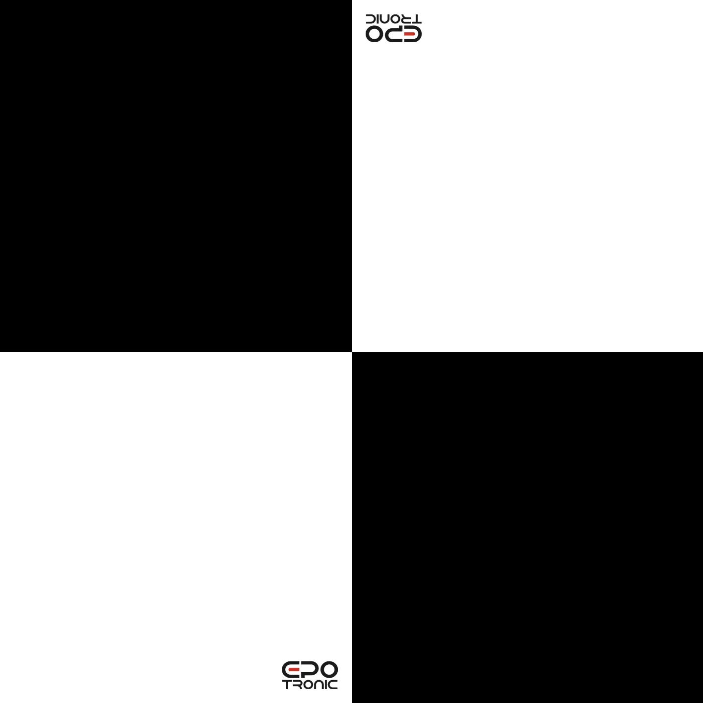
Dieses Set beinhaltet 10 Bodenkontrollpunkte in einem Schachbrettmuster aus hochwertigem, festen und leichtem Aluminiumverbundmaterial in der Größe 25x25cm mit Ecklöchern für die Befestigung im Boden durch Heringe.
Es ist besonders gut für die luftgestützte Vermessung geeignet, insbesondere für photogrammetrische oder laser- basierte Berechnungen.
10x Bodenkontrollpunkte in Schachbrettmuster aus Aluminiumverbundmaterial 25x25cm
0 of 0 reviews
Average rating of 0 out of 5 stars
Leave a review!
Share your experiences with other customers.
Login
No reviews found. Share your insights with others.
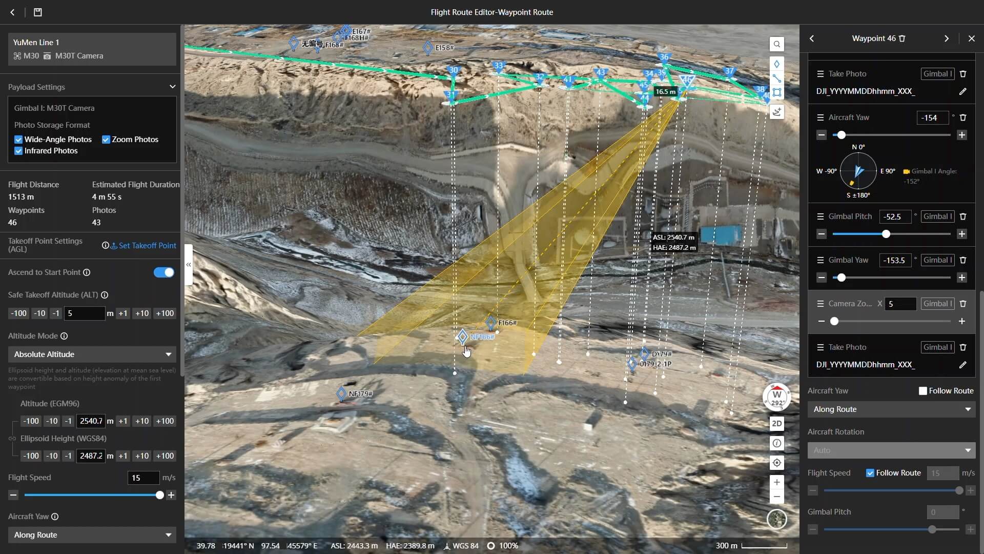
From drone to CAD in a few clicks. Virtual Surveyor provides surveyors with an intuitive desktop software application, enabling them to rapidly create traditional surveying deliverables when using drones.
Using drones represents a big difference in the type of data used traditionally by surveyors. Virtual Surveyor software packages incorporate traditional methods and deliverables to provide an intuitive experience for surveyors with little or no drone experience.
Virtual Surveyor works with point clouds, orthophotos and elevation models generated by drones to create deliverables traditionally created by surveyors.
The peak version is ideal when working with larger projects, and tracking progress over time.
Virtual Surveyor features:
Valley
Import Orthos & DSMs
Import CAD
Convert Point Clouds
Draw Points & Lines
Mosaic Tools
Export to CAD
Ridge
All Valley Features
Create Surfaces
Regular Point Grids
Advanced Editing
Modify Terrain
Stockpile Volumes
Peak
All Ridge Features
Terrain States
Cut/Fill Maps
Remove Objects
Breakline Tools
Intelligent Point Grids
EMLID Reach RS2+ (Multi-Band RTK GNSS Receiver)
Centimetre position
For surveying, mapping and navigation
Comes with a mobile app
Baseline up to 100 km
Update rate 10 Hz
4G LTE sim card slot for network RTK
Gets a fix in seconds
Reach RS2 gets a fixed solution in just seconds and maintains robust performance even in challenging conditions. Centimeter accuracy can be achieved on distances up to 60 km in RTK, and 100 km in PPK mode.
GPS, GLONASS, BeiDou, Galileo, and QZSS
L1OF, L2OF, L1C/A, L2C, E1B/C, E5b, B1I B2I
PPP support
RINEX raw data logs are compatible with PPP services so you can now get centimeter-precise results in any place on Earth. Process RINEX files in an online service and get position with absolute accuracy.
Built-in 3.5G modem
Reach RS2 features a power-efficient 3.5G HSPA modem with 2G fallback and global coverage. Now corrections can be accessed or broadcasted over NTRIP independently, without relying on an Internet connection on your phone.
22 hours on 1 charge
Up to 22 hours of autonomous work when logging data and up to 16 hours as a 3G rover, even in cold weather—no more need to carry spare batteries with you. Reach RS2 can charge from a USB wall charger or a power bank over USB-C.
Range Accuracy: ± 2cm (1σ@20m)
Weight: 1.25kg (Incl.Camera)
Scan Range: 190m @ 10% reflectance 450m @ 80% reflectance
Overview
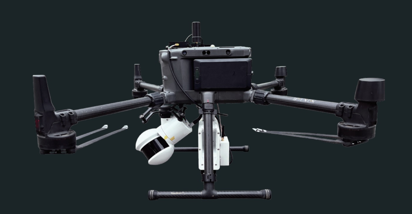
LiAir X3-H is the newest compact, high-performance unit in the LiAir series by GreenValley International. It adopts a new integrated design style and integrates lightweight LiDAR, self-developed inertial navigation, a high-resolution mapping camera, and onboard computer systems providing new levels of efficiency.
Lightweight & Compact - easy-to-use
Integrated simple yet rugged design, allowing for protection against the elements with an IP54 rating. The operation interface is straightforward, allowing one-touch operation for maximum efficiency.
New Built-in Camera - providing ultra-clear picture quality
Built-in new high-resolution custom mapping camera, the image resolution is upgraded from 24 Megapixels to 26 Megapixels, allowing for high-quality true-color point clouds as well as orthophotos for photogrammetry.
LiAir X3-OAG is the newest compact, high-performance unit in the LiAir series by GreenValley International. It adopts a new integrated design style and integrates lightweight LiDAR, self-developed inertial navigation, a high-resolution mapping camera, and onboard computer systems providing new levels of efficiency.
Lightweight & Compact - easy-to-use
Integrated simple yet rugged design, allowing for protection against the elements with an IP54 rating. The operation interface is straightforward, allowing one-touch operation for maximum efficiency.
New Built-in Camera - providing ultra-clear picture quality
Built-in new high-resolution custom mapping camera, the image resolution is upgraded from 24 Megapixels to 26 Megapixels, allowing for high-quality true-color point clouds as well as orthophotos for photogrammetry.
LiGeoreference software included
Range Accuracy: ± 2cm (1σ@20m)
Weight: 1.25 kg (Incl. camera)
Scan Range: 190m at 10% reflectance – 450m at 80% reflectance
Dreiecksstativ 1,88m für Dreifuss
Passend für Emlid Reach-Empfänger. Hinweis: Zum genauen Nivellieren und Positionieren der Station ist ein Dreifuß erforderlich
Hochbelastbares selbstschließendes Dreibeinstativ aus Aluminium mit Tragegurt und Seitenklemmen. Bewährte Langlebigkeit, Verdrehsicherheit und hervorragende Vibrationseigenschaften.
Packlänge 107 cm (3,51 ft), erweiterbar auf 188 cm (6,17 ft), Gewicht 4,5 kg (9,92 lb).
Optimale Stabilität für Ihre Messung
Es verfügt über 3 Ebenen, die eine Höhe von 1,07 bis 1,88 Metern ermöglichen.
EN--------
Triangl Tripod 1.88m for Tribrach
Fits with Emlid Reach receivers. Note: a tribrach is necessary to accurately level and position the station
Heavy duty aluminium self-closing tripod with carrying strap and side clamps. Proven long-life, twist proof and excellent vibrations characteristics. Packaged length 107 cm (3.51 ft), extendible to 188 cm (6.17 ft), weight 4.5 kg (9.92 lb).
Optimal stability for your measurement
It has 3 levels allowing a height of 1.07 to 1.88 meters.
EMLID Reach RS2 (Multi-Band RTK GNSS Receiver)
Centimetre position
For surveying, mapping and navigation
Comes with a mobile app
Baseline up to 100 km
Update rate 10 Hz
4G LTE sim card slot for network RTK
Gets a fix in seconds
Reach RS2 gets a fixed solution in just seconds and maintains robust performance even in challenging conditions. Centimeter accuracy can be achieved on distances up to 60 km in RTK, and 100 km in PPK mode.
GPS, GLONASS, BeiDou, Galileo, and QZSS
L1OF, L2OF, L1C/A, L2C, E1B/C, E5b, B1I B2I
PPP support
RINEX raw data logs are compatible with PPP services so you can now get centimeter-precise results in any place on Earth. Process RINEX files in an online service and get position with absolute accuracy.
Built-in 3.5G modem
Reach RS2 features a power-efficient 3.5G HSPA modem with 2G fallback and global coverage. Now corrections can be accessed or broadcasted over NTRIP independently, without relying on an Internet connection on your phone.
22 hours on 1 charge
Up to 22 hours of autonomous work when logging data and up to 16 hours as a 3G rover, even in cold weather—no more need to carry spare batteries with you. Reach RS2 can charge from a USB wall charger or a power bank over USB-C.
GNSS Postprocessing PPK and Geotagging Software
What is REDtoolbox software?
The software performs a multi-constellation (GPS, GLONASS, Beidou, Galileo) and multichannel (L1, L2, L5) GNSS postprocessing PPK of Base-Rover configurations. Such configurations can be found in many UAV / drone applications such as the Matrice 300 RTK and Phantom 4 RTK. The corrected GNSS path accuracy is at centimeter level, depending on the device use, the current satellite constellation and receipt quality.
Outputted as plain Text, as image EXIF data or in native Agisoft, Pix4d and Google Earth files, these information can be used many other fields of applications., eg. in photogrammetry and documentation.
When should you use REDtoolbox?
REDtoolbox is ideal, first, for acting as a back-up when a Network RTK service is not available, e.g. when cell service is poor, or when RTK connection is lost between the drone and base station during a flight, allowing you to achieve the accuracy you would with normal RTK corrections. REDtoolbox is also ideal for converting captured photos to a local coordinate system, by measuring the offset to GCPs measured locally. Most common photogrammetry software struggle to achieve this to a high accuracy level, especially for less common coordinate systems.
Triangl telescopic carbon surveying pole 2.45m with 5/8" male thread
Passend für Emlid Reach-Empfänger. Hinweis: Zum genauen Nivellieren und Positionieren der Station ist ein Dreifuß erforderlich
Hochbelastbare Aluminiumstange mit Tragetasche und eingebauter Libelle.
Packlänge 137 cm
Max. Messlänge 245 cm
Fixierpunkte: 1.80 m, 2.00 m, 2.20 m, 2.40 m
Gewicht 1,7 kg
Optimale Stabilität für Ihre Messung
Es verfügt über 4 Verstell-Ebenen, die eine Höhe von 1,80 bis 2,45 Metern ermöglichen.
EN--------
Triangl Tripod 1.88m for Tribrach
Fits with Emlid Reach receivers. Note: a tribrach is necessary to accurately level and position the station
Not extended: 1.37 m
Fully extended: 2.45 m
Locking Points: 1.80 m, 2.00 m, 2.20 m, 2.40 m
Total weight: 1.7 kg
Thread: 5/8″ (Compatible with Reach RS2 and other survey equipment)