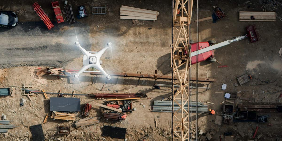
Drone Surveying
Surveying and GIS - map types and areas of application

Fixed-Wing-Drone

What is meant by drone survey?
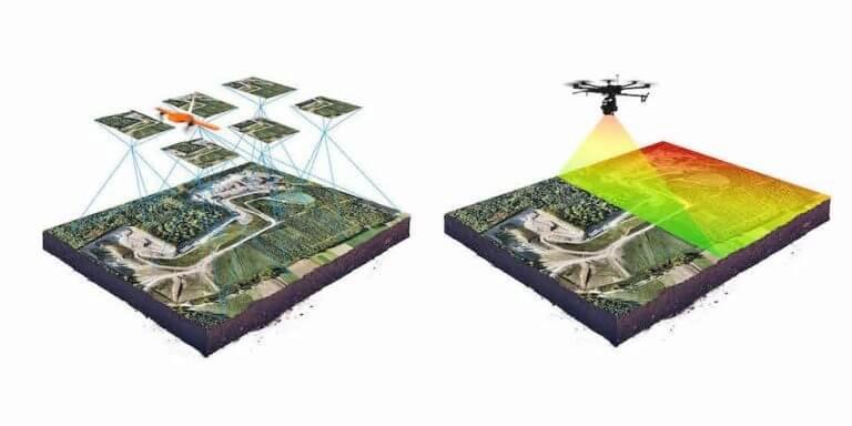
A drone survey refers to the use of a drone, or unmanned aerial vehicle (UAV), to capture aerial data with downward-facing sensors, such as RGB or multispectral cameras, and LIDAR payloads. During a drone survey with an RGB camera, the ground is photographed several times from different angles, and each image is tagged with coordinates.
From this data, a photogrammetry software can create geo-referenced orthomosaics, elevation models or 3D models of the project area. These maps can also be used to extract information such as highly-accurate distances or volumetric measurements. Unlike manned aircraft or satellite imagery, drones can fly at a much lower altitude, making the generation of high-resolution, high-accuracy data, much faster, less expensive and independent of atmospheric conditions such as cloud cover.
What are the benefits of drones in surveying?


Reduce field time and survey costs
Provide accurate and exhaustive data
Map otherwise inaccessible areas
Capturing topographic data with a drone is up to five times faster than with land-based methods and requires less manpower. With PPK geo-tagging, you also save time, as placing numerous GCPs is no longer necessary. You ultimately deliver your survey results faster and at a lower cost.
Total stations only measure individual points. One drone flight produces thousands of measurements, which can be represented in different formats (orthomosaic, point cloud, DTM, DSM, contour lines, etc). Each pixel of the produced map or point of the 3D model contains 3D geo-data.
An aerial mapping drone can take off and fly almost anywhere. You are no longer limited by unreachable areas, unsafe steep slopes or harsh terrain unsuitable for traditional measuring tools. You do not need to close down highways or train tracks. In fact, you can capture data during operation without an organizational overhead.
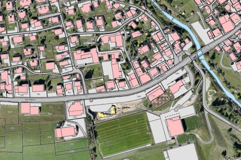
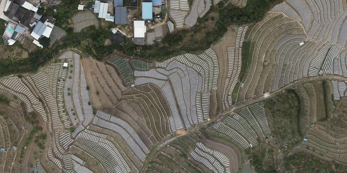
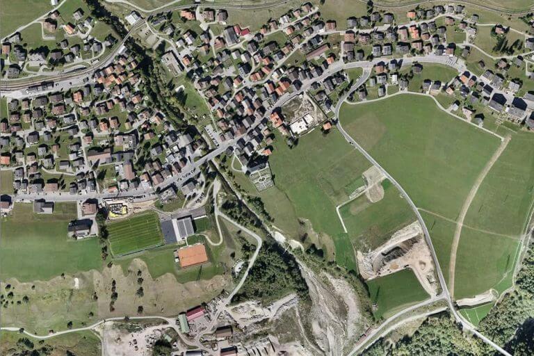
Land surveying / cartography
Survey drones generate high-resolution orthomosaics and detailed 3D models of areas where low-quality, outdated or even no data, are available. They thus enable high-accuracy cadastral maps to be produced quickly and easily, even in complex or difficult to access environments. Surveyors can also extract features from the images, such as signs, curbs, road markers, fire hydrants and drains.
After post-processing with a photogrammetry software, these same images can produce very detailed elevation models, contour lines and breaklines, as well as 3D reconstructions of land sites or buildings.

Traditional challenges in cadastral surveying
Field operations require many man-hours from many teams, exceed project time goals, and result in higher costs. It's difficult to visualize a property or parcel of land using only traditional surveying methods such as vector maps.
How drones improve cadastral surveying
Generate 1:500 scale maps without the use of GCPs, meeting centimeter-level accuracy requirements. Improve data collection and processing efficiency by up to 10x, achieve results quickly, and shorten project duration. Get output in industry standards such as DOM, DSM, 3D reality models, and more. Small teams can work through large areas quickly by controlling multiple drones with a single remote control.
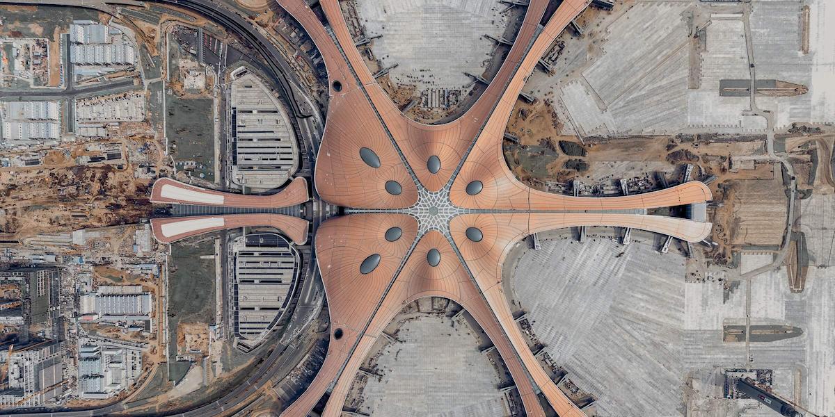
Land management and development
Aerial images taken by drones greatly accelerate and simplify topographic surveys for land management and planning. This holds true for site scouting, allotment planning and design, as well as final construction of roads, buildings and utilities. These images also provide the foundation for detailed models of site topography for pre-construction engineering studies. The generated data can also be transferred to any CAD or BIM software so that engineers can immediately start working from a 3D model. As data collection by drones is easily repeatable at low cost, images can be taken at regular intervals and overlaid on the original blueprints to assess whether the construction work is moving according to plan specifications.
Traditional challenges in managing land cover and land use changes.
Satellite data are expensive and cannot be retrieved on demand at any time, plus their resolution and data accuracy are inadequate. Field operations are slow and inefficient with total stations and handheld RTK equipment. Collecting usable data is difficult in remote areas or locations with obstacles.
How drones help manage land cover and land use changes
Visualize results quickly using real-time 2D orthomosaic imagery or create accurate, high-resolution maps in post-processing. Costs can be significantly reduced by using low-cost drone and software solutions that automate data collection and processing. Keep digital records that can be easily used for regular land cover comparisons so teams can dynamically track changes.

Traditional challenges in conducting topographic surveys.
Extensive field operations are required involving multiple teams and stakeholders. Project costs are high and schedules are long. Projects are often delayed due to inefficient data collection methods. Contour data is not part of the standard deliverables, leading to difficulties in data visualization.
How drones help perform topographic surveys
Generate 1:500 scale maps without the use of GCPs, meeting centimeter-level accuracy requirements. Improve data collection and processing efficiency by up to 10x, achieve results quickly, and shorten project duration. Get output in industry standards such as DOM, DSM, 3D reality models, and more. Small teams can work through large areas quickly by controlling multiple drones with a single remote control.
Precise measurements
High resolution orthophotos enable surveyors to perform highly-accurate distance and surface measurements.
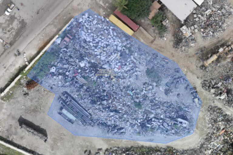
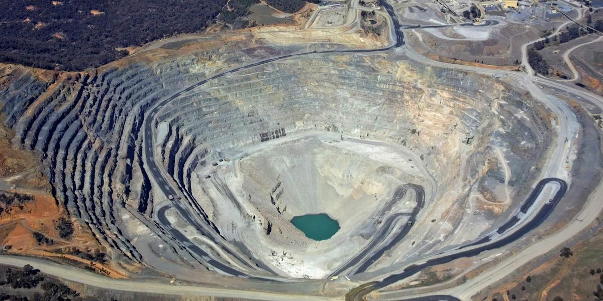
Stockpile volumetric measurements
With 3D mapping software, it is also possible to obtain volumetric measurements from the very same images. This fast and inexpensive method of volume measurement is particularly useful to calculate stocks in mines and quarries for inventory or monitoring purposes. With a drone, surveyors can capture many more topographic data points, hence more accurate volume measurements. They can also do this in a much safer way than if they had to manually capture the data by going up and down a stockpile. Since drones are capturing the data from above, operations on site won’t be interrupted. The short acquisition time enables capturing a site snapshot at a specific point in time.
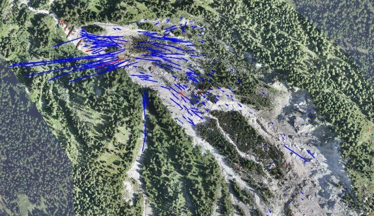
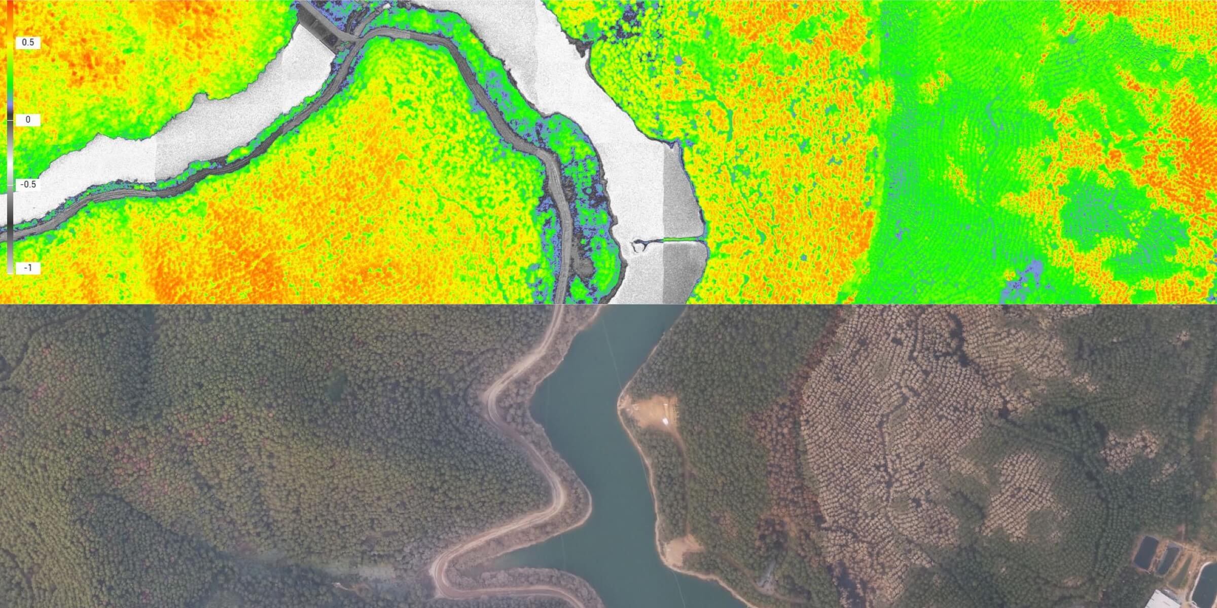
Slope monitoring
With automated GIS analysis, it is possible to extract slope measurements from DTMs and DSMs generated by drone imagery. Knowing the steepness of the ground’s surface, the areas can be classified and used for slope monitoring purposes, including landslide mitigation and prevention. With orthomosaics taken at different times, it is possible to detect changes in earth movement and to measure its velocity. This data can help predict landslides and prevent potential damage to roads, railways and bridges. Compared to traditional monitoring techniques, where sensors are placed on single points, drones enable more comprehensive data collection. Drones with PPK capability, which do not require laying out of multiple GCPs, are optimal for this application, since these areas are often hard to reach or even dangerous.

Traditional challenges in urban modeling
The lack of accurate location data makes it difficult to merge BIM designs, street vector maps, Google maps, and satellite imagery, resulting in costs in time and labor. 2D designs cannot reflect the spatial information needed to fully visualize the design. BIM designs may differ from the reality model, leading to difficulties in visualizing and verifying the design.
How drones help create city models
Take off quickly and fly over cities or rural areas, record data using automated flights, lower your costs and shorten field missions. Create 3D models with accurate, georeferenced data that can be easily fitted into BIM models to visualize designs. 3D models generated using photogrammetry software are compatible with many GIS software solutions, streamlining the design process.

Traditional challenges in urban/rural classification
Classification is often based on a combination of Google Maps, physical maps, and contour maps that are low resolution, not updated frequently enough, and not intuitive. The environment can be complex and include infrastructure such as roads, bridges, and water systems. This can lead to difficulties in mapping. Traditional 2D maps do not capture enough GIS information for an environmental impact assessment, which is required in infrastructure planning. A 3D model would be better.
How drones support urban-rural classification
Surveying drones and software solutions combine multiple types of geographic information into 2D orthomosaic imagery and 3D models to help with classification and planning. Take off quickly and fly over cities or rural areas, record data using automated flights, lower your costs and shorten field missions. The 2D maps and 3D models generated are compatible with a variety of GIS software solutions, so results can be quickly visualized and adjustments made in a timely manner. Aerial drone imagery can be used to create topographic maps for additional functional analysis.

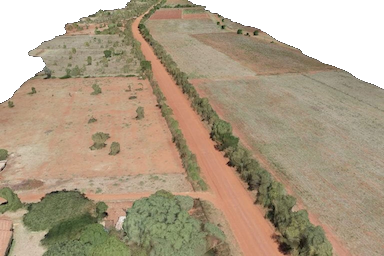
Traditional challenges in corridor mapping
Traditional methods do not produce high-resolution representations with three-dimensional geographic information. The environment can be complex and include infrastructure such as roads, bridges, and water supply systems. This can lead to difficulties in mapping. Corridor-shaped areas or assets such as rivers and power lines can be difficult to map manually, resulting in more man-hours and higher costs.
How drones are helping to map corridors
Surveying drones and software solutions combine multiple types of geographic information into 2D orthomosaic images and 3D models to help with classification and planning. Drones can operate in complex topographies and have intelligent features that follow the topography to ensure flight safety without compromising data accuracy. The 2D maps and 3D models generated are compatible with a wide range of GIS software solutions, allowing results to be visualized quickly and adjustments made in a timely manner.
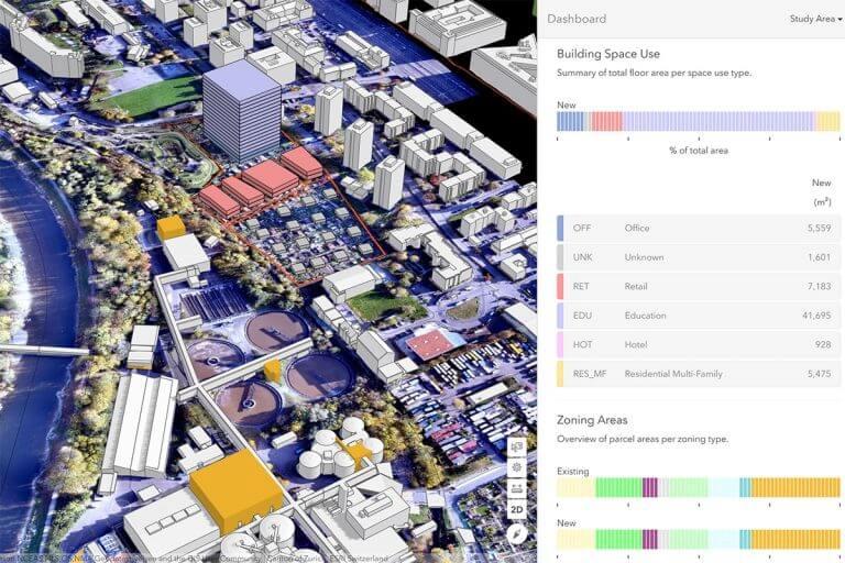
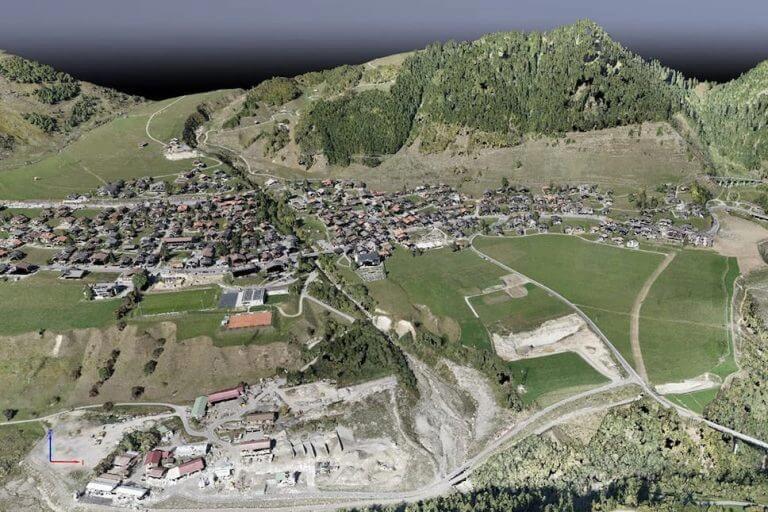
Urban planning
The development of increasingly dense and complex urban areas requires intensive planning and therefore time-consuming and expensive data collection. Thanks to drones, urban planners can collect large amounts of up-to-date data in a short period of time and with far less staff. The images produced in this way allow planners to examine the existing social and environmental conditions of the sites and consider the impact of different scenarios. Thanks to 3D models, buildings can also be easily overlayed onto their environment, giving planners and citizens an experimental perspective of a complex development project. 3D models also allow analysis and visualization of cast shadows and outlooks/views.
Architecture, Engineering and Construction (AEC)
Site surveys using drones generate accurate data that can be used in construction projects from design to completion.
Key benefits:

With the help of drones, you can map large work areas and get detailed, accurate data. 2D maps and 3D models help teams optimize their project planning and designs.
Drone solutions, along with 3D modeling and editing software, help teams stay fully informed of progress and use it as a basis to effectively allocate resources and keep projects on schedule.
Building Inspection and Maintenance
Quickly map and model buildings to digitize the inspection and maintenance process while keeping your staff safe.
Volumetric Stockpile Measurements
Generate accurate volume measurements of supplies and construction aggregates using 3D models from aerial photography.
Create detailed 3D models of cultural and natural monuments, digitize facilities for preservation and education.
Architecture and engineering
Traditional challenges in architectural engineering
The lack of accurate positional data makes it difficult to merge BIM designs, road vector maps, and satellite imagery, costing valuable time and manpower. 2D designs cannot reflect the spatial information needed to fully visualize the design. BIM designs may differ from the reality model, leading to difficulties in visualizing and verifying the design.
How drones support architectural engineering
Create 3D models with accurate positional data that can be easily fitted into BIM models to visualize designs. Designs can be optimized using drone-generated 3D models that are compatible with many GIS software solutions.
Progress Monitoring
Traditional progress monitoring challenges
It is difficult to track construction projects because many teams may be working on a large area at the same time. Fixed cameras on site cannot capture the entire area in detail and fail to capture critical progress information. Large amounts of video can cause important details to be missed, making it difficult to track specific areas of the project.
How drones help with progress monitoring
Drones can create accurate 2D maps and 3D models of the job site as needed. 3D models can be used to track dynamic changes or daily progress.
Building inspections
Traditional building inspection challenges
Traditional building inspections often require skilled workers with manual access via scaffolding, attachments or long distances to the structure. This is time consuming and dangerous. It is often difficult to visualize the building in its entirety, and manual inspections do not produce standardized digital results.
How drones improve building inspection
Quickly create a detailed 3D model of a building for building acceptance, routine inspections and maintenance. Drones from DJI can capture high-resolution close-up images of buildings to create detailed models for inspection.
Stock Volume
Traditional challenges in volumetric stockpile measurement.
Manual operations take days or weeks in hard-to-reach areas where personnel may also be exposed to hazardous materials. Traditional methods cannot create detailed models that result in accurate volume measurements.
How drones help with stockpile measurements
Quickly deploy drones in hard-to-reach areas to collect high-resolution aerial imagery that can be used to create point clouds and accurate 3D models. Fly as often as needed and generate accurate models as needed - even large areas are covered in just a few days.
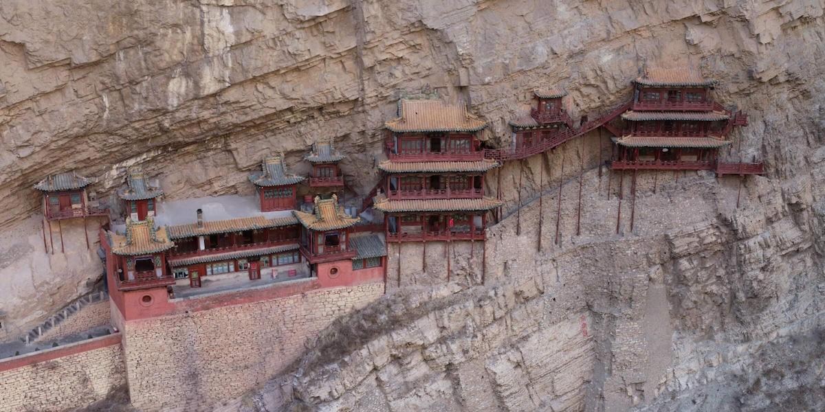
Modeling of cultural monuments
Traditional challenges in modeling cultural monuments
Traditional methods of modeling buildings and monuments are expensive and inefficient, making it difficult to create digital archives. Manual oblique photogrammetry deployments can fail to capture details that meet project accuracy requirements.
How drones help create models of cultural monuments
Drones capture high-resolution images of complex structures that can be used to create 3D models and digital archives and optimize maintenance. Drones from DJI can safely capture close-up images of buildings to create detailed models. Digital copies of cultural monuments help identify, protect and preserve them, bringing benefits to industries such as tourism and education.
Natural Resource Management
Drones enable large-scale, detailed surveys of raw materials, providing maps and models as well as telemetry data.
Key advantages:
Forest Management
Use drones with high-resolution visual sensors and multispectral sensors to map forests, sample vegetation, or monitor and manage forest and wildlife health.
Water Resource Management
Create maps around surface waters, estuaries and more with drones to get data on demand and facilitate resource management and compliance monitoring in vast areas.
Forest Management
Traditional challenges in forest management
Mapping heavily vegetated and often mountainous areas on foot is time consuming, expensive, and dangerous for operators. The data collected can be limited in scope, making it difficult to create comprehensive profiles that can be shared with different teams.
How drones help with forest management
Take off quickly and fly over rivers, lakes, reservoirs and more, recording data using automated flights, lowering your costs and shortening field operations. Aerial imagery helps classify water bodies, estimate water supply, and monitor wastewater.

Water Resource Management
Traditional challenges in water resource management
Mapping surface waters requires many man-hours and a lot of manpower, while the surrounding area can be difficult to access on foot. Satellite data are expensive and cannot be accessed whenever needed, and their resolution and data accuracy are also inadequate.
Orthomosaic maps
Drone images are corrected for image distortion and stitched together during post-processing to create a highly accurate orthomosaic map. Each pixel contains 2D geo-information (X, Y) and can directly provide accurate measurements such as horizontal distances and surfaces.
File Formats: geoTIFF (.tiff), .jpg, .png, Google Tiles (.kml, .html)
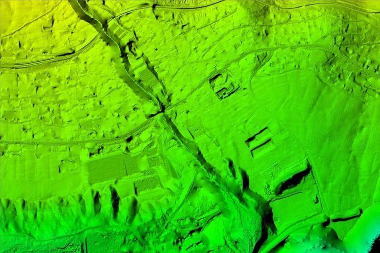
3D point cloud
A condensed point cloud can be generated from drone images. Each point contains geo-information (X, Y, Z) and color information. It provides a very accurate model for distance (oblique and horizontal), area and volume measurements.
File Formats: .las, .laz, .ply, .xyz
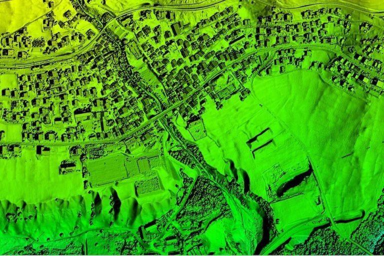
Digital Surface Models (DSM)
Drone imagery can also be used to create DSM models of the area. Each pixel contains 2D information (X, Y) and the height (Z value) of the highest point for that position.
File Formats: GeoTiff (.tif), .xyz, .las, .laz
Digital Terrain Model (DTM)
After filtering objects such as buildings, the drone images can be used to create DTMs, where each pixel contains 2.5D information (X, Y and Z value of the highest elevation).
File Formats: GeoTiff (.tif)
.jpg)
3D textured mesh
The textured 3D mesh is a reproduction of the edges, faces, vertices, and texture of the area captured by the drone. This model is most useful for visual inspection or when external stakeholder or public involvement is essential to a project.
File Formats: .ply, .fbx, .dxf, .obj, .pdf
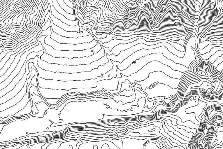
Contour
Depending on the project requirements, either the DTM or DSM model can be used with custom contour line intervals to create a contour line map that gives you a better understanding of the surface of the area captured by the drone.
File Formats: .shp, .dxf, .pdf
Videos


What is the difference between lidar and photogrammetry?
Since some aerial drones can now carry LIDAR sensors, what is the right choice between a LIDAR and a photogrammetric payload? It all depends on the specific use. Find out how these two technologies work, what features they have, and which is best for your project: Drone Lidar vs. Photogrammetry.